4211 entries match your criteria. Entries 101 through 200 are listed.⊲ Previous 100 — Next 100 ⊳
Historical Markers and War Memorials in Missouri
By Jason Voigt, June 25, 2024
Historic Sanborn Field Marker
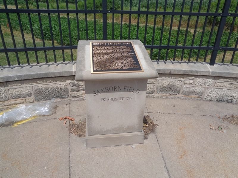
| 101 ► Missouri, Boone County, Columbia — Historic Sanborn Field — |
| On Rollins Street at South College Avenue (Missouri Route 763), on the left when traveling east on Rollins Street. | |||
| 102 ► Missouri, Boone County, Columbia — In Loving Memory of Mrs. Beulah Ralph — |
| On North Providence Road (State Highway 163) at Boone Drive, on the right when traveling north on North Providence Road. | |||
| 103 ► Missouri, Boone County, Columbia — In Memory of the United States Colored Troops of the Civil War — Known to Be Buried in Columbia Cemetery — |
| Near East Broadway just west of North 1st Street, on the left when traveling west. | |||
| 104 ► Missouri, Boone County, Columbia — James Shannon L.L.D. — |
| 105 ► Missouri, Boone County, Columbia — Jewell Cemetery |
| Near Providence Road (Missouri Route 163) south of Green Meadows Road, on the right when traveling south. Reported permanently removed. | |||
| 106 ► Missouri, Boone County, Columbia — Jewell Cemetery State Historic Site — |
| Near South Providence Road (Missouri Route 163) near Green Meadow Road. | |||
| 107 ► Missouri, Boone County, Columbia — Kuhlman Court — |
| Near Hitt Street at Rollins Street. | |||
| 108 ► Missouri, Boone County, Columbia — Lest We Forget: Lynching at the Stewart Road Bridge — |
| Near South Providence Road (State Highway 163) 0.1 miles south of East Stewart Road, on the left when traveling north. | |||
| 109 ► Missouri, Boone County, Columbia — Lynching in America / The Lynching of George Bush — Community Remembrance Project — |
| On Walnut Street west of North 8th Street, on the right when traveling west. | |||
| 110 ► Missouri, Boone County, Columbia — Maplewood Barn and Theatre — Historic Nifong Park — |
| Near East Nifong Boulevard west of Ponderosa Street. | |||
| 111 ► Missouri, Boone County, Columbia — Masonic Historic Site — |
| On East Walnut Street west of North 9th Street, on the right when traveling east. | |||
| 112 ► Missouri, Boone County, Columbia — Memorial Union Tower — |
| On Hill Street, 0.1 miles south of University Avenue, on the left when traveling south. | |||
| 113 ► Missouri, Boone County, Columbia — Missouri, Kansas & Texas Railroad Depot — |
| On South 4th Street at East Broadway, on the right when traveling north on South 4th Street. | |||
| 114 ► Missouri, Boone County, Columbia — Missouri-Kansas-Texas Railroad Yard — Downtown Columbia, MO — |
| On South 4th Street at Cherry Street, on the right when traveling south on South 4th Street. | |||
| 115 ► Missouri, Boone County, Columbia — Neate Building — |
| On East Broadway west of South 8th Street, on the right when traveling east. | |||
| 116 ► Missouri, Boone County, Columbia — Old Boone County Courthouse Columns — |
| On East Walnut Street at North 8th Street, on the right when traveling west on East Walnut Street. | |||
| 117 ► Missouri, Boone County, Columbia — Operation Desert Storm — Persian Gulf War — 1990 - 1991 — |
| Near East Broadway just west of North 1st Street, on the left when traveling west. | |||
| 118 ► Missouri, Boone County, Columbia — Rock Bridge Mills Millstone — Historic Nifong Park — Boone County Historical Society — |
| Near Ponderosa Street south of East Nifong Boulevard. | |||
| 119 ► Missouri, Boone County, Columbia — Sanborn Field and Soil Erosion Plot — |
| On Rollins Street at South College Avenue (Missouri Route 763), on the right when traveling west on Rollins Street. | |||
| 120 ► Missouri, Boone County, Columbia — Sharp End — |
| On East Walnut Street just east of North 5th Street, on the right when traveling east. | |||
| 121 ► Missouri, Boone County, Columbia — Sharp End — |
| On East Walnut Street at North 5th Street, on the right when traveling east on East Walnut Street. | |||
| 122 ► Missouri, Boone County, Columbia — Site of Columbia College — |
| On 6th Street south of Chestnut Street, on the right when traveling south. | |||
| 123 ► Missouri, Boone County, Columbia — Smithton - 1818 — Boone's Lick Road — |
| On West Broadway at Westmount Avenue, on the right when traveling east on West Broadway. | |||
| 124 ► Missouri, Boone County, Columbia — The Diggs Building — |
| On Hinkson Avenue west of Fay Street, on the right when traveling west. | |||
| 125 ► Missouri, Boone County, Columbia — The Easley Country Store — Boone County History & Culture Center — |
| Near Ponderosa Street south of East Nifong Boulevard. | |||
| 126 ► Missouri, Boone County, Columbia — The F.L. Duley - M.E. Miller Erosion Plots — |
| On Hospital Drive at Hitt Street, on the right when traveling west on Hospital Drive. | |||
| 127 ► Missouri, Boone County, Columbia — The Gordon-Collins Log Cabin — Boone County History & Culture Center — |
| Near Ponderosa Street south of East Nifong Boulevard. | |||
| 128 ► Missouri, Boone County, Columbia — The John William "Blind" Boone Home and the Second Missionary Baptist Church — |
| On North 4th Street just north of East Broadway, on the right when traveling north. | |||
| 129 ► Missouri, Boone County, Columbia — The Mel Carnahan Quadrangle — Honoring Leadership in Public Service — |
| On Conley Avenue at Missouri Avenue on Conley Avenue. | |||
| 130 ► Missouri, Boone County, Columbia — The Ryland Farm House — Boone County History & Culture Center — |
| Near Ponderosa Street south of East Nifong Boulevard. | |||
| 131 ► Missouri, Boone County, Columbia — The Wynna Faye Tapp-Elbert Memorial Amphitheater — In Celebration of her life and Achievements in the City of Columbia — October 2, 1944 - February 9, 2014 — |
| On North 5th Street just south of Rogers Street, on the left when traveling north. | |||
| 132 ► Missouri, Boone County, Columbia — Tibbs Building — African American Heritage Trail — |
| On East Walnut Street at North 5th Street, on the right when traveling east on East Walnut Street. | |||
| 133 ► Missouri, Boone County, Columbia — Transportation — Flat Branch Park — |
| On South 4th Street at Cherry Street, on the right when traveling south on South 4th Street. | |||
| 134 ► Missouri, Boone County, Columbia — Union Church Building — |
| On East Walnut Street at North 8th Street on East Walnut Street. | |||
| 135 ► Missouri, Boone County, Columbia — Varsity Theater - 1927 — Cornerstones of Columbia — |
| On North 9th Street north of East Broadway, on the left when traveling north. | |||
| 136 ► Missouri, Boone County, Columbia — Vivion's Stage Stand - 1827 — Boone's Lick Road — |
| On Missouri Route WW, on the right when traveling east. | |||
| 137 ► Missouri, Boone County, Columbia — War Memorial — |
| On Old U.S. 63 south of Shepard Boulevard, on the right when traveling south. | |||
| 138 ► Missouri, Boone County, Rocheport — Edward D. "Ted" and Pat Jones — |
| 139 ► Missouri, Boone County, Rocheport — History of Rocheport — |
| 140 ► Missouri, Boone County, Rocheport — Katy Trail State Park 20th Anniversary — 1990 - 2010 — |
| 141 ► Missouri, Boone County, Rocheport — Steamboating on the Missouri — |
| 142 ► Missouri, Buchanan County, Iatan — Wetland Habitats of the Past — Little Bean Marsh Conservation Area — The Journey of Lewis & Clark — |
| 143 ► Missouri, Buchanan County, Lewis and Clark Village — Lewis and Clark in Missouri — |
| Near Lakeshore Drive. | |||
| 144 ► Missouri, Buchanan County, Lewis and Clark Village — The Lewis and Clark Expedition Across Missouri — |
| Near Lakeshore Drive. | |||
| 145 ► Missouri, Buchanan County, Lewis and Clark Village — The Lewis and Clark Expedition Across Missouri — |
| Near Lakeshore Drive. | |||
| 146 ► Missouri, Buchanan County, St. Joseph — "Queen of the River Towns • King of the Trails" — St. Joseph, Missouri — Great America VI — |
| On Edmond Street at 6th Street, on the right when traveling west on Edmond Street. | |||
| 147 ► Missouri, Buchanan County, St. Joseph — A Path To Freedom — Finding refuge across the river — |
| 148 ► Missouri, Buchanan County, St. Joseph — Ballinger Building — Queen Ann — 1889 — |
| On Edmond Street at 7th Street, on the right when traveling east on Edmond Street. | |||
| 149 ► Missouri, Buchanan County, St. Joseph — Brian Jay Bradbury — May 1, 1984 - June 21, 2006 — |
| On Francis Street at 11th Street, on the left when traveling east on Francis Street. | |||
| 150 ► Missouri, Buchanan County, St. Joseph — Buchanan County Courthouse — Neo-Classical — 1876 — |
| On 5th Street at Jules Street, on the left when traveling north on 5th Street. | |||
| 151 ► Missouri, Buchanan County, St. Joseph — C. B. & Q. 5614 Steam Locomotive — |
| On 10th Street near Seneca Street, on the left when traveling north. | |||
| 152 ► Missouri, Buchanan County, St. Joseph — Christ Episcopal Church — Gothic Revival — 1877 — |
| On Francis Street at 7th Street, on the left when traveling east on Francis Street. | |||
| 153 ► Missouri, Buchanan County, St. Joseph — Coleman Randolph "Hawk" Hawkins — November 21, 1904 - May 19, 1969 — "Body and Soul" — |
| On Felix Street at 7th Street, on the left when traveling east on Felix Street. | |||
| 154 ► Missouri, Buchanan County, St. Joseph — Confederate Memorial — |
| 155 ► Missouri, Buchanan County, St. Joseph — David Johnson Heaton — |
| 156 ► Missouri, Buchanan County, St. Joseph — Donnell Court Building — Neo-Classical — 1902 — |
| On Francis Street at 5th Strret, on the left when traveling east on Francis Street. | |||
| 157 ► Missouri, Buchanan County, St. Joseph — Fort Smith — The Union's hope to hold St. Joseph — |
| 158 ► Missouri, Buchanan County, St. Joseph — German-American Bank — Richarsonian Romanesque — 1889 — |
| On 7th Street at Felix Street, on the right when traveling south on 7th Street. | |||
| 159 ► Missouri, Buchanan County, St. Joseph — Jesse James Home — |
| On Penn Street. | |||
| 160 ► Missouri, Buchanan County, St. Joseph — Joseph Robidoux — City Founder — 1783 - 1868 — |
| 161 ► Missouri, Buchanan County, St. Joseph — Joseph Robidoux at Roy's Branch — |
| 162 ► Missouri, Buchanan County, St. Joseph — Kirkpatrick Building — Beaux Arts — 1923 — |
| On Francis Street at 7th Street, on the right when traveling east on Francis Street. | |||
| 163 ► Missouri, Buchanan County, St. Joseph — Krug Building — Queen Anne — 1904 — |
| On 8th Street at Francis Street, on the right when traveling south on 8th Street. | |||
| 164 ► Missouri, Buchanan County, St. Joseph — Lovers Lane, Saint Jo — |
| On Lovers Lane north of Lindenwood Lane, on the right when traveling north. | |||
| 165 ► Missouri, Buchanan County, St. Joseph — Missouri Valley Trust Company — Commercial Italianate — 1859 — |
| On 4th Street at Felix Street, on the right when traveling north on 4th Street. | |||
| 166 ► Missouri, Buchanan County, St. Joseph — Mount Mora Cemetery — |
| On Mount Mora Road, on the left when traveling north. | |||
| 167 ► Missouri, Buchanan County, St. Joseph — No Turning Back — |
| On Frederick Avenue (Business Interstate 29) at Faraon Street, on the right when traveling north on Frederick Avenue. | |||
| 168 ► Missouri, Buchanan County, St. Joseph — Patee House — Company & Division Headquarters, Original Home Station — Apr. 3 1860 - Sep. 13, 1861 — |
| On Penn Street at 12th Street, on the right when traveling east on Penn Street. | |||
| 169 ► Missouri, Buchanan County, St. Joseph — Patee House - 1858 — The Pony Express — |
| On Penn Street at 12th Street, on the right when traveling east on Penn Street. | |||
| 170 ► Missouri, Buchanan County, St. Joseph — Patee Park Baptist Church — |
| On 10th Street (Business Interstate 29) near Seneca Street, on the right when traveling north. | |||
| 171 ► Missouri, Buchanan County, St. Joseph — Patee Town — |
| On Penn Street at South 10th Street, on the left when traveling east on Penn Street. | |||
| 172 ► Missouri, Buchanan County, St. Joseph — Peace Officers Memorial — |
| On Francis Street at 11th Street, on the left when traveling east on Francis Street. | |||
| 173 ► Missouri, Buchanan County, St. Joseph — Pioneer Building — Georgian Revival — 1872, Facade Rebuilt 1929 |
| Near Francis Street at 5th Street, on the right when traveling east. Reported permanently removed. | |||
| 174 ► Missouri, Buchanan County, St. Joseph — Platte Purchase — 1837-1937 — |
| Near Charles Street at South 11th Street, on the right when traveling east. | |||
| 175 ► Missouri, Buchanan County, St. Joseph — Pony Express — 1860 - 1861 — |
| 176 ► Missouri, Buchanan County, St. Joseph — Pony Express — "Saddle and Mochila" — |
| On 3rd Street at Felix Street, on the right when traveling south on 3rd Street. | |||
| 177 ► Missouri, Buchanan County, St. Joseph — Pony Express Stable — |
| On Penn Street west of South 10th Street, on the left when traveling west. | |||
| 178 ► Missouri, Buchanan County, St. Joseph — Replica of the Statue of Liberty — |
| On Francis Street near 11th Street, on the right when traveling east. | |||
| 179 ► Missouri, Buchanan County, St. Joseph — Saint Joseph — |
| On Penn Street, on the left when traveling east. | |||
| 180 ► Missouri, Buchanan County, St. Joseph — SPC Edward "Eddie" Lee Myers — June 12, 1984 - July 27, 2005 — |
| On Francis Street at 11th Street, on the left when traveling east on Francis Street. | |||
| 181 ► Missouri, Buchanan County, St. Joseph — SPC Joshua James "Josh" Munger — May 6, 1983 - November 2, 2005 — |
| On Francis Street at 11th Street, on the left when traveling east on Francis Street. | |||
| 182 ► Missouri, Buchanan County, St. Joseph — St. Joseph — The Union's Linchpin to the West — |
| 183 ► Missouri, Buchanan County, St. Joseph — St. Joseph Museum — |
| On Charles Street at South 11th Street, on the right when traveling east on Charles Street. | |||
| 184 ► Missouri, Buchanan County, St. Joseph — St. Michael's Prairie / The Lewis and Clark Expedition — |
| 185 ► Missouri, Buchanan County, St. Joseph — The Boder Building — |
| On 4th Street near Felix Street, on the right when traveling north. | |||
| 186 ► Missouri, Buchanan County, St. Joseph — The California - Oregon Trail — 1840s & 1850s — |
| 187 ► Missouri, Buchanan County, St. Joseph — The Civil War in St. Joseph — A State Divided: The Civil War in Missouri — |
| On Penn Street, on the left when traveling east. | |||
| 188 ► Missouri, Buchanan County, St. Joseph — The First Pony Express — |
| On Penn Street near South 10th Street, on the right when traveling west. | |||
| 189 ► Missouri, Buchanan County, St. Joseph — The Journey West — |
| On South 3rd Street near Edmond Street, on the left when traveling south. | |||
| 190 ► Missouri, Buchanan County, St. Joseph — The Lewis and Clark Expedition — |
| 191 ► Missouri, Buchanan County, St. Joseph — The Men of the Corps of Discovery / The Lewis and Clark Expedition — |
| 192 ► Missouri, Buchanan County, St. Joseph — The One-Room Schoolhouse — |
| On South 9th Street (Business Interstate 29) north of Mitchell Avenue, on the left when traveling south. | |||
| 193 ► Missouri, Buchanan County, St. Joseph — The Patee House — |
| On Penn Street near 12th Street, on the right when traveling east. | |||
| 194 ► Missouri, Buchanan County, St. Joseph — The Patee House In The Civil War — A State Divided: The Civil War in Missouri — |
| On Penn Street at 12th Street, on the right when traveling east on Penn Street. | |||
| 195 ► Missouri, Buchanan County, St. Joseph — The Pony Express — by — Albert Fales — |
| On Penn Street near 12th Street, on the right when traveling east. | |||
| 196 ► Missouri, Buchanan County, St. Joseph — The Pony Express — St. Joseph, Missouri — |
| 197 ► Missouri, Buchanan County, St. Joseph — Transcontinental Telegraph — Electrical Engineering Milestone — |
| On Penn Street near 12th Street, on the right when traveling east. | |||
| 198 ► Missouri, Buchanan County, St. Joseph — War Memorial — |
| On Francis Street near 10th Street, on the left when traveling east. | |||
| 199 ► Missouri, Buchanan County, St. Joseph — William Mitchelhill — August 27th 1870 - May 7th 1915 — In Memoriam — |
| 200 ► Missouri, Buchanan County, St. Joseph — World War Memorial — |
4211 entries matched your criteria. Entries 101 through 200 are listed above. ⊲ Previous 100 — Next 100 ⊳