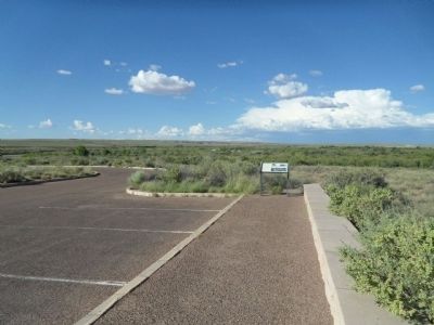
Near Petrified Forest Road, on the right when traveling north.
Across the Puerco River, the tracks of the Burlington Northern Santa Fe Railroad stretch for miles to the east and to the west. With no landforms or forests to block your view, you can see very long trains from beginning to end. More than 60 . . . — — Map (db m119934) HM
U.S. Route 66 (US 66 or Route 66), also known as the Will Rogers Highway, the Main Street of America or the Mother Road, was one of the original highways within the U.S. Highway System. US 66 was established on Nov. 11, 1926, with road signs erected . . . — — Map (db m184319) HM
On Petrified Forest Road at Old U.S. Route 66, on the right when traveling south on Petrified Forest Road.
Petrified Forest is the only National Park in the country with a portion of Historic Route 66 within its boundaries. You are currently standing where the Mother Road used to be, with the line of telephone poles paralleling its alignment through the . . . — — Map (db m163277) HM
On Petrified Forest Road, on the left when traveling north. Reported missing.
You are standing near old Route 66. The line of the roadbed and the telephone poles in front of you mark the path of the famous "Main Street of America" as it passed through Petrified Forest National Park. From Chicago to Los Angeles, this heavily . . . — — Map (db m68904) HM
On East Route 66 at North Leroux Street, on the right when traveling west on East Route 66.
Because of its prime location, this corner, containing two lots, was one of the earliest in Flagstaff to be developed. Pioneer merchant J. R. Kilpatrick built New Town's sixth building here in December 1883. This wooden store building burned in the . . . — — Map (db m119945) HM
On South San Francisco Street, on the left when traveling south.
The K.J. Nackard family came to Flagstaff in 1912 and opened a small general store at 106 E. Railroad Avenue. The store was successful. In 1921, Nackard built a home on this property, just a stone's throw from the store.
Soon afterwards, . . . — — Map (db m119932) HM
On East Route 66 (U.S. 180) west of Fanning Drive, on the right when traveling west.
Beneath the inverted, forked ponderosa entryway awaits an adventure in pioneer history, country-western legends and ghost stories - one of northern Arizona's liveliest landmarks since 1931.
Recognized by Hampton Hotels Save-A-Landmark . . . — — Map (db m192855) HM
On East Route 66 (U.S. 180) 0.1 miles east of North Park Drive, on the left when traveling east.
Built in 1931 by Dean Eldredge
Restored by Martin and Stacie Zanzucchi
Placed in the National Register of Historic Places
by the U.S. Department of the Interior on May 3, 1994
under the authority of Interior Secretary Bruce Babbitt
. . . — — Map (db m236440) HM
On Bill Williams Avenue / Route 66 west of North 1st Street, on the right when traveling east.
In 1926, the Old Trails Highway was officially designated U.S. Highway 66, and it became the "Main Street of America." In 1984, Williams was the last Route 66 town in America to be bypassed by the interstate highway system. Built in 1907, this . . . — — Map (db m33375) HM
On Grand Canyon Avenue / West Route 66 east of North 3rd Street, on the left when traveling east.
Built of locally quarried volcanic rock in 1901, this edifice housed a bank and many businesses displaced by the 1901 fire. These included the local newspaper, telegraph office, and eventually Arnold's, a famous Route 66 eatery. In 1928, the Masonic . . . — — Map (db m33382) HM
On East Bill Williams Avenue (Old U.S. 66) west of North Pine Street, on the right when traveling west.
1925 - Williams had two car camps to service travellers along Route 66 and those going to the Grand Canyon. A car camp consisted of cabins that served as both a garage and sleeping quarters.
1936 - An early gas station on Route 66 after a . . . — — Map (db m193234) HM
Near West Railroad Avenue west of North Grand Canyon Boulevard.
Welcome to Williams, Arizona, located in the heart of the Kaibab National Forest at an elevation of 6,770 feet.
Founded in 1881, Williams was named for the famous trapper, scout and mountain man, "Old Bill Williams." A statue of "Old Bill" . . . — — Map (db m193233) HM
On Grand Canyon Avenue at North Pine Street, on the right when traveling east on Grand Canyon Avenue.
The area around what now is Williams, Arizona, was first explored by a Mountain Man who came to this area in 1876, William Shirley Williams, who was called “Old Bill”.
The town site was created by a cowboy named C.T. Rogers in 1879. . . . — — Map (db m48351) HM
On Interstate 40 Frontage Road west of Dennison T I, on the left when traveling west. Reported missing.
A Route 66 icon since the 1940's. Meteor City Trading Post is home to the "World's Longest Map of Route 66."
Recognized by Hampton Hotels Save-A-Landmark program as a site worth seeing — — Map (db m194738) HM
On West Andy Devine Avenue (Old U.S. 66) west of North 1st Street, on the left when traveling west.
The Powerhouse, Arizona's oldest known reinforced concrete industrial building, generated electricity from 1909 to 1938. After serving as a substation and later a recycling center, it was renovated to its current use and condition in 1997 by the . . . — — Map (db m193159) HM
On Oatman Highway (Old U.S. 66) at Rock Hound Hill Road on Oatman Highway.
This turn of the century gold mining camp was on the original road through the Black Mountains and eventually became Route 66. Burrows came with the miners and still roam the streets today.
Get you Kicks on Route 66 in Arizona. — — Map (db m188974) HM
On Main Street, on the right when traveling north.
World War I was funded partially by the gold out of these mountains in 1912. Oatman boomed from 1910 to the 1920's. Upwards to 8,000 people lived here. Gold mines were closed about 1942. Mines were needed to mine copper for World War II. Blue Ridge . . . — — Map (db m119942) HM
On Historic Route 66 (Arizona Route 66) at Diamond Creek Road, on the right when traveling west on Historic Route 66.
These grounds belong in spirit and enthusiasm to Dallas Quasula Sr., a member of the Hualapai tribe. Dallas, a tribal councilman and elder, was also a highly regarded citizen of the county and graduate of Seligman High School. Dallas served . . . — — Map (db m119933) HM
On Historical Route 66 (U.S. 66 at milepost 127), at Diamond Creek Road (U.S. 66), on the right when traveling east on Historical Route 66. Reported missing.
This property was listed in the National Register of
Historic Places on March 15, 2012. The John Osterman
Gas Station was one of several privately-owned and
operated businesses in the town of Peach Springs during the 1920's through the 1950's. . . . — — Map (db m58605) HM
On Historic Route 66 (U.S. 66 at milepost 127), 0.1 miles west of Diamond Creek Road, on the right when traveling west.
This property was listed in the National Register of
Historic Places on November 21, 2003. The Historic
Peach Springs Trading Post, in downtown Peach Springs
circa 1932, was an important commercial enterprise for
Peach Springs citizens and . . . — — Map (db m58607) HM
On West Hopi Drive, on the right when traveling east.
Dear Mr. Paul Lewis
It is my pleasure to inform you that the Wigwam Village #6 at 811 W. Hopi Dr. in Holbrook was listed on the National Register of Historic Places on May 2, 2002.
As you know, the National Register is the official listing . . . — — Map (db m119936) HM
Opened in 1949, tourists were drawn to stop and see what "here it is" was all about. Their marketing campaign placed mileage signs along the highway counting down the distance to the oversized jackrabbit. — — Map (db m192859) HM
On East 2nd Street (Business Interstate 40) east of Arizona Route 87, on the right when traveling east.
Mary Colter's masterpiece, La Posada was one of the last great railroad hotels and known as one of the fanciest on Route 66.
Recognized by Hampton Hotels Save-A-Landmark program as a site worth seeing — — Map (db m192857) HM
On North Kinsley Avenue at West 2nd Street (Business Interstate 40), on the right when traveling south on North Kinsley Avenue.
This area was dedicated on September 11, 1999 as a tribute to the memorable song of the 1970's that made Winslow, Arizona a town to sing about on famous Route 66. — — Map (db m36329) HM
On 2nd Street (Arizona Route 66), on the left when traveling east.
This date medallion is from the Winslow Bridge that once spanned the Little Colorado River on historic Route 66 just east of Winslow. Because the river had always proved a daunting impediment to travelers, this bridge crossing became a strategic . . . — — Map (db m32781) HM
On Lewis Avenue (Business Route 40) at 5th Street, on the right when traveling west on Lewis Avenue.
Ash Fork is located near the 35th Parallel where, in the 1850's the Army Corps of Topographical Engineers began surveying a future railroad route. Camels were imported and used as beasts of burden, adding to the colorful history of the region. A . . . — — Map (db m33442) HM
Built circa 1926-27
by the Arizona Department
of Transportation
This building constructed of Moenkopi Sandstone, has been listed on the National Register of Historic Places.
The Ash Fork Camp location was selected because it is a . . . — — Map (db m33443) HM
On Lewis Avenue (Business Route 40) at 5th Street when traveling west on Lewis Avenue.
Ashfork, Arizona
Founded 1882
The Coming of Route “66”
1926
Ash Fork was a junction point of the Old Trails (Route 66) and the Grand Canyon – Nogales Highways (US 89), leading to the southern sections of the state. . . . — — Map (db m33502) HM
On Grand Canyon Caverns Road, on the right when traveling west.
An Arizona natural wonder in continuous operation since 1927.
Recognized by Hampton Hotels Save-A-Landmark program as a site worth seeing — — Map (db m194739) HM
On East Huntington Drive (Old U.S. 66) west of Waterfall Way, on the right when traveling west.
The Trails Restaurant started small but vigorous in 1952 on land acquired in unincorporated territory along a two lane road known as Route 66. A welcome stop for travelers, the steak house earned a reputation for its hefty portions, thick soups, . . . — — Map (db m52460) HM
On Broadway at 7th Street, on the right when traveling south on Broadway.
Original terminus of Route 66 (1926-1939) in the heart of
the Historic Broadway Theatre District.
Recognized by Hampton Hotels Save-A-Landmark program as a site worth seeing. — — Map (db m189349) HM
On Figueroa Street north of Avenue 55, on the right when traveling north.
America’s Mother Road
U.S. Route 66, established in 1926, was one of the original highways of the United States Highway System. It originally ran from Chicago, Illinois in the east to its western terminus in Downtown Los Angeles, on . . . — — Map (db m130182) HM
On Ocean Avenue at Santa Monica Boulevard, on the right when traveling east on Ocean Avenue.
Dedicated 1952 to Will Rogers - Humorist - World Traveler - Good Neighbor.
This Main Street of America, Highway 66, was the first road he traveled in a career that led him straight to the hearts of his countrymen. — — Map (db m119616) HM
On Fair Oaks Avenue at Oaklawn Avenue, on the right when traveling south on Fair Oaks Avenue.
A singular example of functional public art by architects Charles and Henry Greene, this 1906 span was one of the country's first reinforced concrete bridges.
Recognized by Hampton Hotels Save-A-Landmark program as a site worth seeing. . . . — — Map (db m206059) HM
On National Trails Highway - Historic Route 66 near Old Amboy Road, on the right when traveling west.
Amboy, settled as early as 1858, became a water stop when the Southern Pacific Railroad laid its tracks through the Cadiz Valley in 1883-84. Following the course of the railroad and the National Old Trails Highway, Route 66 was opened in 1926. Amboy . . . — — Map (db m78532) HM
On National Trails Highway at Cadiz Road, on the right when traveling west on National Trails Highway.
Perhaps no other highway in the U.S. is as fabled as old Route 66. It has been immortalized in song, literature, and even a T.V. series as the main street of America. Automobiles came early to the desert, following the railroad with its reliable . . . — — Map (db m78574) HM
On National Trails Highway (Old Route 66), 16.5 miles east of Amboy, CA., on the right when traveling east.
Six panels are mounted on a base, which tell the story of Route 66 . Reading from left to right - Panel 1: The Story of Route 66
Commissioned in 1926 and soon dubbed "The Mother Road," Route 66 was a great asphalt . . . — — Map (db m33446) HM
On North 1st Avenue west of Lawrence Dale Drive, on the left when traveling south.
One of the finest surviving examples of California's depot-hotels built around the turn of the 19th century. It's also home to the Route 66 "Mother Road" Museum and the Western American Railroad Museum (W.A.R.M.).
Recognized by Hampton . . . — — Map (db m193156) HM
On North Second Street north of East Cozy Avenue, on the left when traveling north.
In 1857, under orders to survey a wagon road from New Mexico to California, General Edward Beale followed the 35th parallel to paths opened by Francis Aubry and Lt. A.W. Whipple. Beale’s orders required importation of camels and drivers to . . . — — Map (db m50561) HM
On East Main Street (Business Interstate 15), on the right when traveling east.
In the early 1920’s, an emigration to California started from the Midwest. Families packed up and headed West on National Old Trails Hwy., and proceeded right along Barstow’s Main street. The depression and dust storms of the 1930’s sent families to . . . — — Map (db m50530) HM
On National Trails Highway (U.S. 66), on the right when traveling east.
From Chicago to Santa Monica Route 66 was dotted with roadside cafes and gas stations. These stops provided a respite for those traveling The Mother Road offering a refreshing soft drink, a burger and fries, or an eye-popping cup of coffee as well . . . — — Map (db m242749) HM
On Lanfair Road, 0.1 miles north of Goffs Road, on the left when traveling north.
The first school in Goffs opened its doors for the fall term in 1911 serving the needs of cattle ranches, mining districts, homesteaders, the railroad, and, most of all, the people supporting expanding travel on the National Old Trails Road – . . . — — Map (db m78575) HM
On Mariposa Road, 0.2 miles north of Joshua Street, on the left when traveling north.
This was as close as Hesperia
got to Route 66. In 1940, Leroy
and Della Rolar opened a
service station-cafe on this
property to help serve
increasing motorists'
needs along Route 66.
State Highway 31-C
became U.S. Route 66 in
1928. Actually . . . — — Map (db m166730) HM
On Cajon Boulevard, on the right when traveling east.
Cajon Pass, separating the San Bernardino and San Gabriel ranges, has long been an important natural gateway. It is traversed by Indian trails, emigrant routes, railroads, and a superhighway. Early in the nineteenth century it became the southern . . . — — Map (db m119252) HM
On 5 Mile Road west of Interstate 40, on the left when traveling west.
The Evolution of Route 66
Commissioned in 1926 and dubbed the "Mother Road," Route 66 linked Chicago and Los Angeles - a highway of hope that led thousands of people to a new life in the West.
In 1926, less than half of Route 66 was . . . — — Map (db m201747) HM
On Quinn Court at G Street, on the right when traveling west on Quinn Court.
Formerly one of the grandest Harvey House Hotel, Restaurant & Santa Fe Train Stations. The hotel and restaurant were open from 1908 to 1949. The train station closed in 1988.
Recognized by Hampton Hotels Save-A-Landmark program as a site . . . — — Map (db m33445) HM
On National Trails Highway, 2 miles west of Fort Cady Road, on the right when traveling west.
Originally built in the 1950s, this world-famous restaurant was the location of the 1988 film, "Bagdad Café," which became the new name of the restaurant in 1995. — — Map (db m160081) HM
On National Trails Highway, on the right when traveling west.
The history of Newberry Springs can be traced back more than 20,000 years. Digs at the Early Man Site north of here discovered tools dating prior to 20,000 BC. At that time, much of the land was covered by the prehistoric Lake Manix. Then, around . . . — — Map (db m119927) HM
On Wagon Train Road, 0.5 miles south of Highway 138, on the right when traveling south.
Dedicated July 4, 2019 in commemoration of the original
Camp Cajon Monument located about
300' north of this site, and
dedicated July 4, 1919. — — Map (db m158045) HM
On Wagon Train Road, 0.5 miles south of California Route 138, on the right when traveling south.
Erected in honor of the brave pioneers of California in 1917 by pioneers Sheldon Stoddard, Sydney F. Waite, John Brown Jr., George Miller, George M. Cooley, Silas C. Cox, Richard Weir, Jasper N. Corbett — — Map (db m157687) HM
On Wagon Train Road (Old U.S. 66) 0.5 miles south of California Route 138, on the right when traveling south.
William M. Bristol, founder of Camp Cajon: 1859-1941
William Bristol came to Southern California in 1882, and purchased an orange orchard in East Highland in 1891. He married Francis "Fannie" Dearborn in 1893, and the Bristol's went on to . . . — — Map (db m208068) HM
On Foothill Boulevard just west of Archibald Avenue, on the right when traveling west.
The Cucamonga Service Station was built by Henry Klusman in 1915 on the State Route which would 10 years later, be designated as U.S. Route 66. This type and style of station is one of the few remaining that once numbered in the thousands and . . . — — Map (db m119923) HM
On Foothill Boulevard (Route 66) at Vineyard Avenue, on the right when traveling west on Foothill Boulevard.
Established by Tiburcio Tapia, to whom the Cucamonga Rancho was granted March 3, 1839 by Governor Juan Bautista Alvarado of Mexico.
text on the interpretive sign:
The Thomas Winery . . . More than a century of service. . . . — — Map (db m149064) HM
On Foothill Boulevard (Route 66) 0.2 miles east of Hellman Avenue, on the right when traveling west.
The "El Camino Real Bells" have long been in place since the early part of the last century to mark the original route of "El Camino Real" from San Diego to Sonoma in California. The El Camino Real, (Royal Highway or King's Highway), closely follows . . . — — Map (db m150315) HM
On Foothill Boulevard east of Baker Avenue, on the left when traveling east.
Directly to your right are examples of the types of pavements used in California highway building during the early 1900s.
This road was originally part of the Old Spanish Trail, used by early California explorers and settlers as a stagecoach . . . — — Map (db m120642) HM
On Foothill Boulevard, 0.1 miles east of Grove Avenue, on the right when traveling east.
The Magic Lamp Inn has been a dining tradition on Route 66 since 1955.
Recognized by Hampton Hotels Save-A-Landmark program as a site worth seeing. — — Map (db m158338) HM
On Foothill Boulevard (Route 66) at Vineyard Avenue, on the right when traveling west on Foothill Boulevard.
This site sits at the base of the prominent Red Hill Landmark. The early historic importance of the property stems from its proximity to a reliable water source, Cucamonga Creek, and to its location on the major roadway between Los Angeles and San . . . — — Map (db m117911) HM
On North E Street near West 14th Street, on the right when traveling south.
McDonalds hamburgers and fries represent a true slice of Americana. This site is ground zero for all modern day fast food chains.
Museum owned and operated by Juan Pollo restaurants — — Map (db m204525) HM
On North Mount Vernon Avenue (Old U.S. 66), on the right when traveling north. Reported missing.
Built in 1945, this park continues to provide a center reminiscent of early Mexican Heritage.
Recognized by Hampton Hotels Save-A-Landmark program as a site worth seeing. — — Map (db m204524) HM
On North Mount Vernon Avenue (Old U.S. 66) north of West 6th Street, on the right when traveling south.
Established in 1937, this family-owned restaurant has brought history and tradition to San Bernardino's west side for more than 60 years.
Recognized by Hampton Hotels Save-A-Landmark program as a site worth seeing — — Map (db m204523) HM
Route 66 was established in 1926 as the original U.S. Highway linking Chicago and Los Angeles. The route passed right by this property. During its early years, automobiles were fairly primitive and unreliable. Cars similar to this "Model T" kiddie . . . — — Map (db m211854) HM
On North E Street at West 14th Street, on the left when traveling north on North E Street.
Dick and Mac McDonald opened the world’s first McDonald’s Self-Service, Drive-In Restaurant on this site in San Bernardino, California, December 1948.
They previously operated a successful Drive-In Barbeque Restaurant with Carhop Service on . . . — — Map (db m120644) HM
On D Street (Business Interstate 15) east of 5th Street, on the right when traveling east.
Built in the late 1930s as "Red Rooster," later "Les Pyrenees Restaurant." Museum dedicated to those who lived, passed through and passed on here.
Recognized by Hampton Hotels Save-A-Landmark program as a site worth seeing — — Map (db m193155) HM
On National Trails Highway (County Route 66) 1.3 miles north of Interstate 15, on the left when traveling north.
Emma Jean's Holland Burger Cafe a Route 66 icon has been serving up meals to locals and hungry travelers on the highway since 1947. The building was built by Bob and Kate Holland from cinder blocks manufactured at the old fiber tile plant located . . . — — Map (db m78518) HM
On Ogden Avenue at Elmwood Avenue, on the right when traveling east on Ogden Avenue.
This corridor was a gateway into the country’s interior. Several well worn Indian trails were traveled by fur traders and explorers. One trail, the future Ogden Avenue, was improved into a plank toll road creaking beneath the weight of settlers’ . . . — — Map (db m157105) HM
On Ogden Avenue at Clarence Avenue, on the right when traveling west on Ogden Avenue.
Route 66 was a traveling showroom for new cars in the 1950s. Bold design, streamlining, chrome, and flaring fins captured people’s imagination. Ogden Avenue became a hub for automobile businesses in the Chicago area. In its heyday, the strip . . . — — Map (db m157677) HM
On Ogden Avenue west of South Lombard Avenue, on the right when traveling west.
(front:)
Route 66, the Mother Road, is an American icon that symbolizes romance and freedom of the open road. Born in 1926, Route 66 was one of the first numbered U.S. highways, journeying 2,500 miles from Chicago to Los Angeles. Today, . . . — — Map (db m159132) HM
On Ogden Avenue at Wenonah Avenue, on the right when traveling west on Ogden Avenue.
Ogden Avenue was designed for automobiles when the car was king of American culture. A wide street lined with drive-through businesses and convenient parking served both travelers and residents. Drive-in restaurants, service stations, and auto . . . — — Map (db m157675) HM
On Ogden Avenue at Maple Avenue, on the right when traveling east on Ogden Avenue.
Looking for a quick bite? After World War I, fast food restaurants sprang up along Route 66, offering cheap and speedy meals for people on the go. Ogden Avenue is still home to many restaurants that were popular during the heyday of the Mother . . . — — Map (db m157676) HM
On Joliet Road west of South LaGrange Road (U.S. 45), on the right when traveling north.
Early travelers on Route 66 raced through open lands once they left Chicago. This was truly “countryside,” a rich region of farms and quarries on the outskirts of the city. Few farms remained by the time the City of Countryside was . . . — — Map (db m157673) HM
On North Frontage Road south of S Quincy Road, on the right when traveling east.
The Chicken Basket was established in 1946 born out of a gas station next door that sold fried chicken. It was a Blue Bird bus stop as well as a restaurant and used to have ice skaters on the roof to attract Route 66 travelers. It became Dell . . . — — Map (db m157104) HM
On North Frontage Road south of South Quincy Street, on the right when traveling east.
Most businesses on Route 66 began as combinations of gas stations, garages, and lunch counters. At the Chicken Basket, tasty food won out over gasoline sales. Throughout the 1940s and 50s, hungry travelers flocked to the popular restaurant. But in . . . — — Map (db m157100) HM
On East Mazon Street at North Center Street on East Mazon Street.
Thank you to Bob and Peggy Kraft for donating this Route 66 Hall of Fame streetcar to Gardner.
The Krafts provided years of food, fun and nostalgia at their Riviera Roadhouse located on Route 66. The Riviera unfortunately burned down on June 8, . . . — — Map (db m159247) HM
This nostalgic barn has been restored by volunteers of the Route 66 Association of Illinois Preservation Committee. August 30, 1998 — — Map (db m157025) HM
On Prairie Avenue at Chippewa Street on Prairie Avenue.
The architecture of Dwight has always attracted Route 66 travelers. The Keeley Institute for treating alcoholism was founded here and brought the Village national attention. As the institute gained popularity, Dwight became a “model . . . — — Map (db m158401) HM
On West Waupansie Street (Old U.S. 66) at West Mazon Street (Illinois Route 17), on the right when traveling north on West Waupansie Street. Reported permanently removed.
Built in 1933, Ambler's Texaco was the longest operating service station to pump gas on historic Route 66.
Recognized by Hampton Hotels Save-A-Landmark program as a site worth seeing — — Map (db m189147) HM
On West Waupansie Street north of West Mazon Avenue (Illinois Route 17), on the right when traveling north.
(front:)
Route 66, the Mother Road, is an American icon that symbolizes romance and freedom of the open road. Born in 1926, Route 66 was one of the first numbered U.S. highways, journeying 2,500 miles from Chicago to Los Angeles. Today, . . . — — Map (db m158308) HM
On West Waupansie Street north of West Mazon Avenue (Illinois Route 17), on the right when traveling north.
The Ambler-Becker Texaco Station operated longer than any service station on Route 66. It was run by local families for 66 years, from 1933-1999. Flats were fixed, breakdowns towed, and at times, the spirits of weary travelers restored. . . . — — Map (db m158375) HM
On Old U.S. 66 at South Street, on the right when traveling north on U.S. 66.
During the heyday of Route 66 from the 1930s to the 50s, there were no motel chains. Instead, local families operated small campgrounds, cabins, and motor courts. The Paulsen-Strufe Motel, built in 1935, was more than just a place to stay; it . . . — — Map (db m158384) HM
Lions Lake is a testament to the changing face of Route 66. Dwight started as a farming community on the Chicago & Alton Railroad. When automobiles began replacing horses, people demanded better roads. Borrow pits, like Lions Lake, supplied the . . . — — Map (db m158382) HM
On S West Street at West Deer Street on S West Street.
This restoration is a project of the Route 66 Association of Illinois Preservation Committee. Identified November 9, 1997 on the National Register of Historic Places. — — Map (db m157019) HM
On South West Street at West Hamilton Street, on the right when traveling north on South West Street.
From 1926 to 1946 this road was known as the "Mother Road" or Route 66
During this period traffic was so congested that it became necessary to build an underground passage to safely cross church goers and school children. You are now standing . . . — — Map (db m157023) HM
On North Division Street north of West Jefferson Street, on the right when traveling south.
This venerable old bridge enters its golden years serving slow traffic on a city street, but it started life in the fast lane of the "hard road." In 1924, Illinois Route 4 became the first paved road to connect Chicago with St. Louis. Only two . . . — — Map (db m158825) HM
On Prairie Street at North Ladd Street, on the right when traveling east on Prairie Street.
Civic leaders welcomed Route 66 through Pontiac in 1926 as a boon for business. However, parents were concerned about their children crossing this "dangerous speedway.' As a solution, the State Highway Commission excavated a tunnel under the . . . — — Map (db m158311) HM
On North Division Street north of West Jefferson Street.
The original bridge was built in 1926 as part of Route 4. On November 11, 1926, the alignment of Route 4 through Pontiac became US Route 66. In early days, the highways were marked with paint using a stencil on utility poles and on bridge end posts. . . . — — Map (db m157015) HM
On North Main Street south of West Howard Street (Illinois Route 116), on the right when traveling south.
You are traveling on one of the most famous roads in the world. On September 25, 2005, Illinois Route 66 was designated as a National Scenic Byway by the U.S. Department of Transportation. — — Map (db m158309) HM
Route 66 has become a nostalgic symbol of Americana. This display honors just one of the many mom & pop businesses that served weary travelers on the Mother Road. At it's original location, many thousands of people from around the world stopped to . . . — — Map (db m163373) HM
For decades the bricks to build this pathway were covered by asphalt on Washington St. in Pontiac. They were unearthed during a road work project in 2008. Until 1930 this stretch of Washington Street was the detour route for Illinois Route 4 (SBI . . . — — Map (db m163376) HM
On West Lincoln Avenue north of West Custer Avenue, on the right when traveling east.
Route 66 was one of the most dangerous roads in the nation, earning it the nickname “Bloody 66.” From this District 6 Headquarters building, State Police patrolled the hard road between Dwight and McLean. They enforced safety laws . . . — — Map (db m158312) HM
On North Main Street south of West Howard Street (Illinois Route 116), on the right when traveling south.
(front:)
Route 66, the Mother Road, is an American icon that symbolizes romance and freedom of the open road. Born in 1926, Route 66 was one of the first numbered U.S. highways, journeying 2,500 miles from Chicago to Los Angeles. Today, . . . — — Map (db m158306) HM
This building was home to state troopers who risked their lives every day patrolling Route 66.
By the 1940s, Route 66 carried more traffic than any other highway in the state. The Illinois District 6 State Police Headquarters was built . . . — — Map (db m158812) HM
Bob Waldmire was born near Springfield in 1945. His prolonged passion for Route 66 began in 1962 when his parents took the entire family on a motoring trip to California via Route 66. During that trip, Bob fell in love with the Mother Road and all . . . — — Map (db m163377) HM
Route 66 provided a steady income for family businesses like Joe and Victor "Babe" Selotis' Log Cabin Inn. Joe barbecued beef and pork on a spit out back, while Babe filled gas tanks and fixed flats. When Route 66 was relocated to the backside . . . — — Map (db m158821) HM
357 entries matched your criteria. The first 100 are listed above. Next 100 ⊳