On South High Street north of Chambersburg Street, on the right when traveling south.
Agriculture has always been a part of the culture of the South Mountain area. Settlers were originally drawn to a wild land to cultivate the soils and raise crops, and today agricultural and community leaders to work together to inspire a new . . . — — Map (db m159876) HM
On Cashtown Road, 0.3 miles east of New Road, on the right when traveling east.
Pennsylvania is well known for its beautiful farming country, fruit belts and unique barns. Many are located along the historic Lincoln Highway route. The Round Barn is one of the more unique examples.
Considered an "endangered species," . . . — — Map (db m167237) HM
To the Glory of God, St. John Neumann, then Bishop of Philadelphia, laid the original cornerstone of St. Joseph's Church on July 31, 1859. The church was completed the following year through the work of Rev. Basil A. Shorb, founding pastor. This . . . — — Map (db m130320) HM
On East Main Street (Pennsylvania Route 116) just east of North Miller Street, on the right when traveling west.
This bell is from St. John's United Church of Christ which united with Zion Lutheran to form a new congregation in 1968, St. John Lutheran Church. It is a reminder of God's call to the faithful to worship in this region and a symbol of Christian . . . — — Map (db m159858) HM
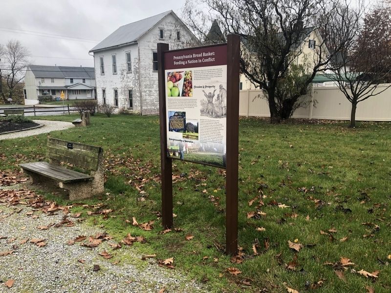
On Jacks Mountain Road at Old Waynesboro Road, on the right when traveling north on Jacks Mountain Road.
At this site, on December 8, 1842, the Lutheran Church of Fountaindale was consecrated by pastor Solomon Sentman. The church was built on land owned by Joseph and Isaac Baugher, and previously owned by Daniel Sprenkle. In 1842, there were 55 . . . — — Map (db m134154) HM
On Chambersburg Street (U.S. 30) just east of South Washington Street, on the right when traveling east.
Completed in 1836, Christ Evangelical Lutheran Church's building is the oldest in Gettysburg used continuously for religious worship. During the battle of Gettysburg it became a haven for serving humanity. When the first wounded appeared along . . . — — Map (db m18121) HM
On W High Street west of Washington Street, on the right when traveling west.
Erected in 1853, this church served as a field hospital during and after the Battle of Gettysburg in 1863. While the church was substantially altered in 1925, much of the original Civl War era structure remains intact. Within its walls some 200 . . . — — Map (db m65783) HM
Curious townspeople gathered near the Seminary on the morning of July 1, "all eager to witness a brush with the Confederates and not dreaming of the terrible conflict that was to occur on that day." As soon as the fighting began in earnest, . . . — — Map (db m66722) HM WM
On North Washington Street, 0.1 miles south of West Stevens Street.
Born a free African-American. He taught the Colored people at this college, 1837, while a student at the Lutheran Seminary. A historian, he was elected bishop of the A.M.E. Church, 1852, and was president of Wilberforce University, 1863-76. — — Map (db m40951) HM
On Seminary Ridge Avenue, 0.2 miles south of Buford Avenue (U.S. 30), on the left when traveling south.
Daniel A. Payne was born a free person of color in Charleston, South Carolina and came to Gettysburg Seminary in 1835 to study theology after a law prohibiting the education of slaves forced him to close his school and abandon teaching. With his . . . — — Map (db m66679) HM
On Steinwehr Avenue (Business U.S. 15), on the right when traveling south.
Built in 1776 by the Rev. Alexander Dobbin. In use for some 25 years as one of the first classical schools west of the Susquehanna River. It is now a museum refurnished in keeping with the early period. — — Map (db m122380) HM
On West High Street at South Washington Street, on the right when traveling east on West High Street.
Built 1813-1814 For Gettysburg Academy Lutheran Theological Seminary 1826-1832 Gettysburg College 1832-1837 Plaque erected 1982 by Gettysburg College — — Map (db m12004) HM
On North Hay Street, on the right when traveling south.
The Lutheran Theological Seminary is the oldest continuing graduate and professional school of the Lutheran tradition in the Americas. Its campus has long been a crossroads of history. We invite you to walk the steps of the soldiers who fought . . . — — Map (db m91301) HM
Constructed in 1832 under the leadership of the Reverend Samuel Simon Schmucker, the brick federal-style building was an impressive home for the Lutheran Theological Seminary at Gettysburg. In July 1863, as war engulfed Gettysburg, the building . . . — — Map (db m66762) HM WM
On East Middle Street, on the right when traveling east.
This structure, built in 1822, served as the Methodist Church for nearly 50 years and still retains a portion of the original burial ground at the rear. After the battle, wounded were cared for here by the Catholic Sisters of Charity from nearby . . . — — Map (db m17461) HM
On North Washington Street at Chambersburg Street (U.S. 30), on the right when traveling south on North Washington Street.
A gift to Gettysburg College in 1990 from George W. Olinger and Mac E. Olinger, life long residents of Gettysburg, zestful supporters of local history, common sense preservationists and quiet, humanitarians. Their gift of these historic buildings . . . — — Map (db m29799) HM
The Lutheran Theological Seminary at Gettysburg held its inaugural session in 1826 with one professor, eight students, a small collection of books, and less than $1700. Seminarians adhered to a rigid schedule. The day started with a 5:00 a.m. . . . — — Map (db m66663) HM
On Legion Alley, 0.1 miles east of Baltimore Street (Business U.S. 15), on the left when traveling east.
Buried in this historic cemetery
are some of the pioneer organizers
of Methodism in Adams County.
To these and others known only to God,
the Congregation of the Gettysburg
United Methodist Church
dedicate this monument
October 1990 . . . — — Map (db m96250) HM
On Baltimore Street (Business U.S. 15) at East High Street, on the right when traveling north on Baltimore Street.
(top):
Abraham Lincoln attended services at this church on November 19, 1863, the day he dedicated the National Cemetery and delivered his Gettysburg Address. The pew he occupied has been retained in the sanctuary.
(lower): . . . — — Map (db m19248) HM
Founder of the Lutheran Theological Seminary and nearby Gettysburg College, Samuel Simon Schmucker (1799-1873) guided the school through its early years and the tumultuous Civil War period. Intelligent, energetic, well educated, and deeply pious, . . . — — Map (db m66668) HM
On Seminary Avenue, on the left when traveling south.
1832 Oldest standing building in America for Lutheran Theological Education 1863 Civil War hospital & lookout station 1961 Home of Adams County Historical Society — — Map (db m15304) HM
On W High Street west of Washington Street, on the right when traveling west.
During the Battle of Gettysburg this house of God became a hospital for wounded soldiers. Within its hallowed walls brave men of North and South foes on the field of battle through weeks of pain were nursed with tender and equal care by the Sisters . . . — — Map (db m65796) HM
On York Street (Lincoln Highway) (U.S. 30) at South Stratton Street, on the right when traveling east on York Street (Lincoln Highway).
Services conducted here when local militia company, Independent Blues, left in response to Lincoln’s Call in April 1861. Mary Virginia Wade, only civilian killed during the Battle of Gettysburg, confirmed here, April 20, 1862. Church then on this . . . — — Map (db m105373) HM
On South Washington Street at Breckenridge Street, on the right when traveling south on South Washington Street.
St. Paul's A.M.E. Zion Church, erected in 1917, is the third church to be used by Gettysburg's oldest African American congregation—founded ca. 1838 in a small frame building on nearby Franklin Street. Members of this congregation have long . . . — — Map (db m130259) HM
On Baltimore Street (Business U.S. 15) at West High Street, on the right when traveling south on Baltimore Street.
The first Episcopal services in Gettysburg were held at the courthouse in 1867. The first church building of the parish was built on Stevens St. in 1876. Conceived as a memorial to the dead of both sides in the Civil War, the cornerstone of this . . . — — Map (db m19250) HM
On Springs Avenue just east of Seminary Ridge Avenue, on the right when traveling west.
Erected in 1833, the President's House served as the home of Professor Samuel S. Schmucker during his long tenure at the Seminary. Runaway slaves reportedly received aid and temporary shelter in a nearby barn before they continued on their . . . — — Map (db m66669) HM
On North Hay Street at Elm Street, on the right when traveling south on North Hay Street.
Beginning in the late 17th century, large waves of European settlers flooded into William Penn's colony in pursuit of opportunity and religious freedom. By the early 19th century, American Lutheran leaders realized that an institution dedicated . . . — — Map (db m66662) HM
On East High Street at South Stratton Street, on the right when traveling west on East High Street.
Congregation formed 1790
First foundation laid 1812
Present church built 1851
Civil War hospital 1863
WW I "Y Hut" Camp Holt 1918 — — Map (db m217053) HM
On Emmitsburg Road (Business Pennsylvania Route 15) at Ridge Road, on the right when traveling south on Emmitsburg Road.
Chaplain
This tablet
marks the spot where
the Rev. Samuel Henry Stein, D.D. L.L.D.
met his death
December 20, 1930
Chaplain
of the
Firemen's Association
of the
State of Pennsylvania
1914-1930
Erected to his memory
by . . . — — Map (db m90690) HM
On Fairfield Road (State Highway 116) at Knoxlyn Road, on the right when traveling west on Fairfield Road.
Present building erected 1790 by a Presbyterian congregation dating from 1748. Later remodeled, its exterior preserves much of the old-style design. — — Map (db m10774) HM
On York Road (U.S. 30), on the right when traveling east.
Army of the Potomac Medical Department Location of the Field Hospitals During the Battle of Gettysburg 1st Corps - July 1st at the Lutheran Theological Seminary and in Gettysburg July 2nd near White Church on Baltimore Pike 2nd Corps - July 2nd . . . — — Map (db m13265) HM
On Basilica Drive just south of Chapel Drive, on the right when traveling north.
The Catholic Faith was brought from Maryland about 1730 to Conewago which became an important Jesuit mission foundation.
From here the faith spread over a great area of Pennsylvania and Western Maryland.
A log chapel was built . . . — — Map (db m180227) HM
On Basilica Drive just south of Chapel Road, on the right when traveling north.
When the church was constructed in 1787, there was only a weather vane on the roof.
In 1830, a cupola was built, and a bell cast in 1816 in Belgium and weighing 300 pounds was installed. This bell was removed in 1891, sent first to . . . — — Map (db m159890) HM
On Basilica Drive just south of Chapel Road, on the right when traveling north.
The stone used in the construction of this building are from the Robert Owings "Mass House," which was erected approximately one-half mile directly north of this site on a 500 acre tract of land granted to him in 1732 by Lord Baltimore. . . . — — Map (db m159893) HM
On Hanover Road (State Highway 194) at Christ Reformed Church Road (County Route 2023), on the right when traveling south on Hanover Road.
Known as "Mother of Reformed Churches" of this region. Congregation organized, May 1747, marking settlement of German pioneers in southern part of Conewago Valley. Section of present building erected, 1798. Many notable persons lie buried in the . . . — — Map (db m10848) HM
On Christ Church Road, 0.2 miles north of Hanover Pike (Pennsylvania Route 194), on the right when traveling north.
The congregation was organized May 4, 1747 by the Rev. Michael Schlatter who was sent by the Synods of Holland to Pennsylvania.
On this site stood the first church, a log structure, which was replaced in 1798 by a brick church. This edifice . . . — — Map (db m14860) HM
On North Third Street north of Main Street (Pennsylvania Route 116).
Conewago historian
Postmaster, writer, printer, bookbinder, storekeeper (store located 50 yards from this site), 7 children, wrote 14 books and 85 periodicals
Most persistent gatherer of Catholic historical matter in the country. Martina J. . . . — — Map (db m130319) HM
On York Road (U.S. 30), on the right when traveling east.
Four miles south of New Oxford. Original Jesuit chapel built 1787 still in use and one of oldest in the United States. The mission was founded 1730. First Sacred Heart church in Pennsylvania. — — Map (db m44548) HM
On Main Street (Pennsylvania Route 94) at N D Alley, on the right when traveling north on Main Street.
This parish was founded in 1746, at Huntington, by the Rev. Richard Locke to whom the Episcopal churches in Carlisle and York also owe their founding.
Civil War Building
July 1863 — — Map (db m91233) HM
On Old Harrisburg Road (Old U.S. 15) (Business Pennsylvania Route 3001) at Oxford Road (Pennsylvania Route 1016), on the right when traveling north on Old Harrisburg Road (Old U.S. 15).
This is the oldest Methodist place of worship in this region. Built originally in 1773. Rebuilt in 1849, the second building is still standing about a mile north of this point on the side road. — — Map (db m10358) HM
On Allegheny Avenue at West North Avenue, on the right when traveling north on Allegheny Avenue.
Has Been Designated A
National Historic Landmark
This site possesses national significance in commemorating the history of the United States of America.
Henry Hobson Richardson, one of America's premier architects, designed this church (1884). . . . — — Map (db m176700) HM
On Bethel Church Road east of Marshall Road, on the right when traveling east.
Founded 1776, in the Old Stone Manse in South Park, by Reverend John McMillan, pioneer minister and educator. It is the mother of five nearby churches and has given its name to the community. In the cemetery, 14 Revolutionary War soldiers from this . . . — — Map (db m122311) HM
On Conroy Street south of Greenock Buena Vista Road, on the right when traveling south.
This bell was removed from the Bell Chapel Methodist Church by John Hoak and donated to the Buena Vista Volunteer Fire Company. It is placed here in remembrance of the church members, the various pastors, and to Jack Junn for his 50 plus years of . . . — — Map (db m245319) HM
On Old Bower Hill Road at Church Street, on the right when traveling south on Old Bower Hill Road.
Oldest Episcopal Church in southwestern Pennsylvania, founded after the French and Indian War by veteran Major William Lea on his land grant. Francis Reno was the first vicar. Church members included General John Neville, the unpopular tax collector . . . — — Map (db m245526) HM
Near McCrady Road at Beulah Road (Pennsylvania Route 130).
This historic chapel, a landmark in the Pittsburgh area since 1837, is the third building occupied by the congregation of the Beulah Presbyterian Church, which was organized in 1784. Preceeded by two log buildings, the chapel is built of bricks made . . . — — Map (db m122316) HM
On Allegheny River Boulevard at Maryland Avenue on Allegheny River Boulevard.
The deep roots of religious tradition in Oakmont date back to 1857 with the establishment of the Oakmont Presbyterian Church. Throughout the 1900s, several more churches were established. As these congregations grew, some of these early church . . . — — Map (db m213347) HM
Near Allegheny Square East west of East Commons, on the left when traveling north.
Pastor Russell formed a Bible study group in Allegheny City in the 1870's; developed it into the Watch Tower Bible and Tract Society. It became the legal corporation for Jehovah's Witnesses. He lived in the Bible House nearby, 1894-1909; spoke here . . . — — Map (db m40173) HM
On Stockton Avenue at Anderson Street, on the right when traveling west on Stockton Avenue.
This defining document of American Reform Judaism was signed by eighteen rabbis at the Concordia Club near here, November, 1885. The 8-point statement encouraged ecumenical dialogue, emphasized the progressive nature of Reform Judaism, and . . . — — Map (db m41047) HM
On Sixth Avenue, 0.1 miles south of Wood Street, on the right when traveling south.
Dr. Nathaniel Bedford
Died March 21, 1818 Aged 63
Surgeon at Fort Pitt
Trustee under Penn Grant to Trinity Church, 1787
Incorporator of Pittsburgh Academy now University of Pittsburgh, 1806
Burgess of Pittsburgh, 1806 . . . — — Map (db m236153) HM
On Oliver Avenue just east of Wood Street, on the right when traveling east.
In commemoration of the grant of this land for the Presbyterian Church and for Trinity Church by the heirs of William Penn in 1787, and in honor of the officers of the Colonial and Revolutionary Armies who after assisting in the achievement of . . . — — Map (db m156265) HM WM
On Sixth Avenue, 0.1 miles south of Wood Street, on the right when traveling south.
This whole city block at one time held as many as 4,000 graves. An ancient Indian tumulus (burying ground) originally occupied part of the site and, subsequently, the French of Fort Duquesne (1754) and the British from Fort Pitt (1758), along with . . . — — Map (db m74735) HM
A.B. Miami University
Oxford Ohio 1857
Western Theological Seminary
of the Presbyterian Church 1859
Ordained 1859
D.D. Miami University 1914
A founder of the
Sigma Chi Fraternity
at Miami University
Oxford Ohio
June the . . . — — Map (db m225110) HM
Pastor of
St. Mary's Congregation
from it's organization
in 1853
to the date of his death
July 1885,
aged 69 years.
———————•—————
May he rest in peace. — — Map (db m224946) HM
Born in Ireland A.D. 1768;
Came to Pittsburgh as Pastor
of Old. St. Patrick's April 1820;
Founded St. Paul's Church in 1829;
Died July 17, 1833.
——————————————
"Let the priests who rule well be
esteemed worthy of double honor; . . . — — Map (db m224940) HM
Born October 25, 1870
Ordained June 26, 1897
Died November 16, 1934
Erected in loving remembrance
of their first pastor
by the members of
The Church of the Assumption,
Bellevue, Pa. — — Map (db m224937) HM
Born County Kerry, Ireland
March 18, 1879
Ordained June 14, 1903
Died April 5, 1944
In memory of our pastor
Founder of the
Nativity of Our Lord Church
North Side, Pittsburgh, Pa. — — Map (db m224933) HM
Founder and Pastor of
St. Anselm Parish, Swissvale
1903 - 1940
Born Macroom, Ireland Jan. 12. 1868
Ordained All Hallows June 25, 1893
Died Pittsburgh Mar. 31, 1940 — — Map (db m224934) HM
On Penn Avenue at 8th Street, on the right when traveling east on Penn Avenue.
Frances Warde and six companions from Carlow, Ireland, opened the first Mercy convent in the U.S. here. Founding date was December 21, 1843, and at once the sisters began to serve the city's poor, sick, and uneducated. From here, Mercy convents . . . — — Map (db m40904) HM
On Lockhart Street at Moravian Way, on the left when traveling west on Lockhart Street.
Progressive reformer and advocate for women, children, immigrants, and the poor. A founder
of the National Council of Jewish Women and its second president, Rosenberg lived here. NCJW's immigrant aid leadership raised awareness of and actively . . . — — Map (db m207627) HM
Near Pressley Street at North Canal Street, on the right when traveling east.
Pittsburgh's Grand Hall at the Priory
(formerly St. Mary's German Catholic Church)
Father John Stibiel, designer; Sidney F. Heckert, architect for vestibule 1854; vestibule 1906 — — Map (db m65227) HM
On First Avenue at Smithfield Street, on the right when traveling west on First Avenue.
Founded 1808 & known as the African Church. Chartered in 1818. Located nearby in early years, church was site of area's first school for colored children, 1831, and statewide civil rights convention, 1841. Congregation moved to Wylie Avenue, 1872; . . . — — Map (db m42023) HM
Near Forbes Avenue just west of Ross Street, on the right when traveling west.
"If they honor me for the pigmy things I have already done, what will they say when they see Pittsburgh finished."
Henry Hobson Richardson, by any standard, was one of the very greatest architects in the history of American . . . — — Map (db m156233) HM
This tablet commemorates the First Holy Mass at Fort Duquesne, celebrated April 16th, 1754, by the Reverend Denys Baron, chaplain to the French forces in occupancy. — — Map (db m65608) HM
On Cemetery Lane, 0.2 miles north of Perry Highway (U.S. 19), on the right when traveling north.
Born on March 28, 1811 in Prachatitz, Bohemia · Ordained June 25, 1836 in New York City · In 1840 joined the Redemptorists · Became a United States citizen in 1848 · In 1852 named Bishop of Philadelphia by Pope Pius IX · Died January 5, 1860 · . . . — — Map (db m181790) HM
On Shady Avenue at Walnut Street, on the right when traveling north on Shady Avenue.
January 2, 1921 from Calvary Church for the first time in history a church service was broadcasted by radio wireless by the Westinghouse Electric and Manufacturing Company. — — Map (db m65042) HM
1127 entries matched your criteria. The first 100 are listed above. Next 100 ⊳