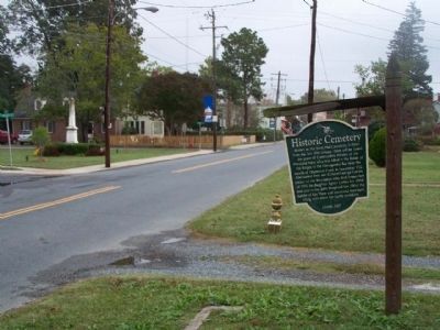
On Market Street near South Street, on the left when traveling west.
Known as the Scott Hall Cemetery, it dates from the late 18th century. Here will be found the grave of Commodore Whaley of the Maryland Navy who was killed in the Battle of the Barges in the Chesapeake Bay near the mouth of Onancock Creek in . . . — — Map (db m7681) HM
On Main Ridge Road south of Garman Road, on the right when traveling south.
Many people ask about the gravestones in front yards. While not unique to Tangier Island and seen throughout the Eastern Shore of Virginia, these are more obvious on such a small island. A number of reasons have been given for these burial sites: . . . — — Map (db m106973) HM
Erected in Gratitude to God And in grateful, remembrance of his servant and minister Francis Makemie, who was born in Ramelton, County Donegal, Ireland, A.D. 1658(?) was educated at Glasgow University, Scotland, and came as an ordained Evangelist to . . . — — Map (db m7838) HM
Commemorates the belief that in this ancient family cemetery were buried near the remains of Francis Makemie, those of his wife Naomi, his daughters Elizabeth and Madame Anne Holden, and his father-in-law, William Anderson. Also those of John . . . — — Map (db m7840) HM
On Rockfish Gap Turnpike (U.S. 250) west of Crozet Avenue / Miller School Road (Virginia Route 240), on the right when traveling east.
The Rothwell Family of Albemarle County Virginia.
Claiborne one of the first of the Rothwells to live in this county, was born about 1741 as reported in The Virginia Advocate, Saturday Oct. 11, 1828 and “died on Oct. 6 in his 87th . . . — — Map (db m3996) HM
On Ivy Road (Business U.S. 250) near Colonnade Drive.
Jesse Pitman Lewis (d. March 8, 1849), of the Virginia Militia, and Taliaferro Lewis (d. July 12, 1810), of the Continental Line, two of several brothers who fought in the War for Independence, are buried in the Lewis family cemetery 100 yards south . . . — — Map (db m3994) HM
After Jefferson's death in 1826, his heirs sold his property, including his slaves, to pay his debts. Naval officer Uriah Phillips Levy, who admired Jefferson for his support of religious liberty, purchased Monticello in 1834 to preserve it. This is . . . — — Map (db m80808) HM
Near Monticello Loop, 0.3 miles north of Thomas Jefferson Parkway (Virginia Route 53), on the left when traveling south.
This graveyard had its beginning in an agreement between two young men, Thomas Jefferson and Dabney Carr, who were school-mates and friends. They agreed that they would be buried under a great oak which stood here.
Carr, who married Jefferson's . . . — — Map (db m80807) HM
On Ivy Farm Road (County Route 1015), on the left when traveling east.
"In 1779 4,000 prisoners, British and their German auxiliaries, captured at the Battle of Saratoga in 1777, marched over 600 miles to quarters, called 'The Barracks', situated a half mile north of this site. Traditionally, some of these prisoners . . . — — Map (db m37586) HM
On Gordonsville Road (Route 231) 0.1 miles south of Millwood Lane (County Road 783), on the left when traveling south.
The vestry of Fredericksville Parish commissioned a church for this site in 1745. First known as Middle Church, the wood-frame building was later called Walker's Church. Thomas Jefferson attended the nearby classical school of the Rev. James Maury, . . . — — Map (db m170120) HM
On Hardware Street (Virginia Route 795) 0 miles north of Valley Street (Virginia Route 20).
In memory of the soldiers who died in the Confederate General Hospital in Scottsville
1862-1863
Beattie, F.M. Co. H 23 NC
Boyle, Andrew Co. D 41 VA
Brashear, Denis P. Co. E 4 AL
Clark, Henry Co. E 15 AL
Clark, Hosey L. Co. F 2 MS . . . — — Map (db m22784) HM
On James River Road (Virginia Route 742) 0.2 miles east of Warren Ferry Road, on the right when traveling east.
Just to the south was Mount Warren, the home of Wilson Cary Nicholas. He served in the Continental army, represented Albemarle County in the General Assembly (1784–1789, 1794–1799), and was a delegate to the Virginia Convention of 1788 . . . — — Map (db m19406) HM
On Holland Lane at Jamieson Avenue, on the right when traveling north on Holland Lane.
[Plaque on the left side of the entrance:]
From the establishment of Alexandria in 1749 to the present time, African Americans have been a vibrant part of this city's history. The City of Alexandria would not exist in its present form were . . . — — Map (db m131547) HM
On North Washington Street south of Cameron Street, on the right when traveling south.
"How sleep the brave who sink to rest
By all their country's wishes blest"
Beneath this mound lie the remains of thirty-four
Confederate Soldiers
Which were disinterred from the Alexandria Soldiers' Cemetery . . . — — Map (db m129286) HM WM
On Cameron Street east of North Union Street, on the right when traveling east.
Living history
Discover the spirit of Alexandria that has been making history for centuries.
Alexandria has had a role in our nation's history since its founding in 1749. George Washington called Alexandria home in his . . . — — Map (db m236052) HM
Near North Columbus Street just south of Cameron Street, on the right when traveling north.
Lieut. Col U.S.A., Revolutionary War
1st Battalion, Lancaster County
Pennsylvania Associators, 1777
Assistant Deputy Quartermaster General
Member of
The Pennsylvania Constitutional Convention, July, 1776
Original stone removed . . . — — Map (db m195645) HM WM
On Oronoco Street at North Washington Street (Virginia Route 400), on the right when traveling east on Oronoco Street.
Built by Philip Richard Fendall in 1785 on land purchased from Henry (Light Horse Harry) Lee. Lee was a brilliant cavalry officer in the Revolution, close friend of George Washington, Virginia Assemblyman, member of Congress and Governor of . . . — — Map (db m128768) HM
Near West Braddock Road, 0.2 miles west of Marlboro Drive, on the right when traveling west.
In 1884, James F. Jackson purchased the largest parcel in "The Fort," a post-Civil War African American community. He paid $300 for his 11.5 acres with the "western slope of a bank of Fort Ward." James and wife Catherine (Katie/Kittie), natives . . . — — Map (db m149737) HM
Near West Braddock Road east of North Howard Street, on the right when traveling west.
In 1939, Samuel Javins conveyed the land which was referred to as "Oakland Church lot" nine years earlier, to the Oakland Baptist Church, after the death of his wife, Florence McKnight Javins. She inherited the property from her mother, Harriet . . . — — Map (db m81223) HM
Near West Braddock Road, 0.1 miles west of Marlboro Drive, on the right when traveling west.
Several residents of "The Fort" community were founders of the Oakland Baptist Church, which is located at the intersection of King Street and Braddock Road. The congregation started worshiping in a bush arbor as Oak Hill Baptist Mission in 1888 . . . — — Map (db m81185) HM
Near South Washington Street just south of Church Street, on the right when traveling south.
Under this plaza is the concrete floor of a gas station, the construction of which desecrated many graves. The flooring was kept in place to protect the graves that may remain below. — — Map (db m188799) HM
Near Wilkes Street west of Hamilton Avenue when traveling west.
Civil War Dead
An estimated 700,000 Union and Confederate soldiers died in the Civil War between April 1861 and April 1865. As the death toll rose, the U.S. government struggled with the urgent but unplanned need to bury fallen Union . . . — — Map (db m92115) HM
Near Wilkes Street west of Hamilton Avenue when traveling west.
Securing the Capital
On May 24, 1861, Gen. Winfield Scott ordered eleven regiments of Union troops from Washington, D.C., across the Potomac River, where they captured Arlington and Alexandria.
After their defeat in July at Manassas, . . . — — Map (db m92113) HM
Near Wilkes Street, 0.1 miles east of Hamilton Avenue, on the right when traveling east.
Henry A. Crump 60th Inf • William M. David 62nd Inf • George W.L. Francis 7th Cav • William H. Haws 8th Inf • George W. Herndon 13th Inf • Elias M. Herring 18th Inf • Elijah F. Hutchison 6th Cav • Edward S. Jett 56th Inf • John J. Knoxville 9th . . . — — Map (db m150721) HM WM
On Wilkes Street, 0.1 miles east of Hamilton Avenue, on the right when traveling east.
Brown, Alexander H. • Carter, Merriwether T. • Darley, William • Jones, George W. • Lawler, John Joseph • Lewis, William L. • Pitts, Henry Segar • Pitts, Robert Tyler • Proctor, John J. • Roland, Richard N. • Sutherland, John W. • Turner, Albert . . . — — Map (db m150723) HM WM
On South Washington Street south of Church Street, on the right when traveling south.
The Contrabands and Freedmen Cemetery Memorial is dedicated to honoring more than 1,700 people of African descent buried here during and following the Civil War, as well as those who may have been laid to rest after the cemetery officially . . . — — Map (db m77244) HM WM
On Church Street at South Columbus Street when traveling north on Church Street.
Seeking freedom and a chance to begin a new life thousands of African Americans fleeing slavery flooded Civil War-era Alexandria. The city was quickly overwhelmed, and as living conditions grew dire, many perished from disease and deprivation. In . . . — — Map (db m86652) HM
Near Wilkes Street, 0.1 miles east of Hamilton Avenue, on the right when traveling east.
Courtesy of Bethel Cemetery,
Est. 1885
on whose grounds rests ten members of Col. John Singleton Mosby's Rangers, 43rd BN CSA. The area of Northern Virginia was known during the war and ever since as Mosby's Confederacy
Ayre, George . . . — — Map (db m150722) HM WM
On Wilkes Street, 0.1 miles west of South Payne Street, on the right when traveling west.
The Douglass Cemetery Association was founded in 1895 as a non-denominational, segregated cemetery for Alexandria's African American community. The Douglass Cemetery is named in memory of Frederick Douglass, who was an American abolitionist, . . . — — Map (db m140586) HM
Near South Washington Street at Church Street, on the right when traveling south.
We are not contrabands, but soldiers of the U.S. Army. We have cheerfully left the comforts of home, and entered into the field of conflict, fighting side by side with the white soldiers…
As American citizens, we have a right . . . — — Map (db m87058) HM
On South Washington Street (Local Route 400) at Church Street, on the right when traveling south on South Washington Street.
Federal authorities established a cemetery here for newly freed African Americans during the Civil War. In January 1864, the military governor of Alexandria confiscated for use as a burying ground an abandoned pasture from a family with Confederate . . . — — Map (db m122082) HM
Near South Washington Street just south of Church Street, on the right when traveling south.
Many of the African Americans who fled to Alexandria to escape enslavement and those already living here succumbed to disease and deprivation during and shortly after the Civil War. Carts bearing the dead entered the cemetery along a path in this . . . — — Map (db m188795) HM
On South Washington Street at Church Street, on the right when traveling south on South Washington Street.
During the Civil War, Freedmen's Cemetery extended into the middle of South Washington Street. Each tan stone in the sidewalk marks a grave identified by archaeologists investigating the location of the original cemetery. — — Map (db m188794) HM
On South Payne Street south of Prince Street, on the right when traveling south.
During the Civil War, 217 was the headquarters of the L'Overture Hospital. It was named after Tousaint L'Overture — Hispaniola's (Haiti) slave revolt leader. Patients were African American Union Soldiers & “contrabands” (escaped . . . — — Map (db m74279) HM WM
On Hamilton Avenue south of Wilkes Street, on the right when traveling south.
In this cemetery rest the earthly remains of Patriots in the Revolutionary War, many of whom were of Scottish ancestry.
These Patriots, along with many Presbyterians from Alexandria, fought for the cause of Liberty and assisted the Soldiers . . . — — Map (db m129163) HM
On South Payne Street just south of Franklin Street, on the right when traveling south.
The Alexandria's Board of Trustees established Penny Hill Cemetery in 1796 as the town's municipal burial ground. The cemetery became the final resting place for indigent and unidentified people in the City, as well as residents. Because nearly all . . . — — Map (db m188793) HM
On South Washington Street (Virginia Route 400) north of Capital Beltway Inner Loop (Interstate 95), on the left when traveling north.
During the Civil War, Alexandria's population swelled with more than 20,000 enslaved African Americans fleeing Confederate territory for safety behind Union lines. Initially called Contrabands because they were considered "property" taken during . . . — — Map (db m127734) HM
On Business Center Drive south of Witter Drive, on the left when traveling north.
James and Mary Bloxham, whose descendants are interred within this cemetery, came to Alexandria from England in the late 18th century. By the mid-19th century, two of their sons — William, a miller by trade, and James (II), a farmer — had settled . . . — — Map (db m216714) HM
On Selma Low Moor Road (Virginia Route 696) 0.2 miles west of Oakland Drive, on the right when traveling west.
During the Civil War, the Jackson River Depot was located here. It marked the western terminus of the Virginia Central Railroad, which extended 200 miles from Hanover Junction north of Richmond. Located just east of the Kanawha Pass of the Allegheny . . . — — Map (db m107980) HM
Near Selma Low Moor Road (Virginia Route 696) 0.2 miles west of Oakland Drive (Virginia Route 1002), on the right when traveling west.
In continuous use as a place of worship except for a period between 1861 and 1865 when it was used as a hospital for a contingent of General T.J. (Stonewall) Jackson's troops encamped nearby.
A monument in the churchyard marks the graves of . . . — — Map (db m46379) HM
Near Selma Low Moor Road (Virginia Route 696) 0.2 miles west of Oakland Drive (Virginia Route 1002), on the right when traveling west.
William Henry Haynes, Sr. donated land for the Oakland Church and cemetery in 1811 to trustees James M. Montague, John P. Haynes, David Williamson and William H. Haynes, Jr. But the deed was not recorded until 1859. The original structure is said . . . — — Map (db m46378) HM
On Church Street at Virginia Street, on the left when traveling west on Church Street.
Noted lawyer and statesman William Branch Giles was born 12 Aug. 1762 in Amelia County and educated at Hampden-Sydney College, Princeton, and the College of William and Mary. Giles served Virginia in the United States House of Representatives . . . — — Map (db m19039) HM
On Patrick Henry Highway (Virginia Route 151) north of Winton Road (County Route 736), on the right when traveling north.
In the grove of trees some hundreds of yards to the west is the grave of Sarah Winston (Henry), mother of Patrick Henry, who died in November, 1784. — — Map (db m123090) HM
On Old Courthouse Road (Virginia Route 24), on the right when traveling west.
Here are buried eighteen Confederate soldiers who died April 8 and 9, 1865 in the closing days of the War Between the States. The remains of one unknown Union soldier found some years after the war are interred beside the Confederate dead. About 500 . . . — — Map (db m156470) HM
On Old Courthouse Road (Virginia Route 24), on the right when traveling west.
Buried here are nineteen men (out of perhaps 100) killed during the last two days of war in Virginia. These men were at first buried where they died – at hospitals or in farm fields and woodlots around Appomattox Court House. But in 1866, the . . . — — Map (db m5990) HM
Near Old Courthouse Road (Virginia Route 24), on the right when traveling west.
Son of (Francis & Maria Meeks,) Born March 2, 1843; and died in the defence of his country October 4, 1861 at Fairfax Court House Va. He was a member of the Appomattox Rangers, in which Company he served faithfully in the battles Bull Run and . . . — — Map (db m169635) HM
On Old Courthouse Road (Virginia Route 24), on the left when traveling west.
The 30-foot obelisk marks the Raine family cemetery. Erected in 1912 by C. Hunter Raine, the monument honors past family members, including C. Hunter’s father, Charles James Raine, who served as a captain in the Lee Battery of Virginia Artillery. . . . — — Map (db m36257) HM
On Old Courthouse Road (Virginia Route 24), on the left when traveling west.
(Front):Erected by C. Hunter Raine in loving memory of his father Chas. J. Raine captain of Lee Battery, Co. A, Virginia Artillery, C. S. A. Killed in the Battle of Mine Run Va., November 30th, 1863 and the members of the family buried . . . — — Map (db m15520) HM
On National Park Drive, 0.2 miles north of Old Courthouse Road (Virginia Route 24), on the right when traveling north.
Brothers Henry and Thomas Bocock built this house in 1848. Henry was the County Clerk of Appomattox (1845-1860). Thomas served as a U. S. Congressman from 1847 to March 1861, when he became the only Speaker of the Confederate House of . . . — — Map (db m234617) HM
This home incorporates the original log house built about 1800 by William Carlin. It is one of the earliest structures remaining in Arlington. At one time, Carlin had been a tailor in Alexandria whose clients included George Washington. Mr. Carlin’s . . . — — Map (db m56352) HM
Obverse:
Reached the North Pole on April 6, 1909, with Robert E. Peary and four Polar Eskimos.
[Caption with image of group at Pole:] Ooqueah, Ootah, Henson, Egingwah, Seegloo.
Matthew Alexander Henson Re-interment . . . — — Map (db m11773) HM
[East face, top of the arch:]
McCLELLAN
Here rest 15,585 of the 315,555 citizens who died in defense of our country from 1861 to 1865.
"On fame's eternal camping ground their silent tents are spread, And glory guards with . . . — — Map (db m24587) HM
In sacred memory of those who died in a distant land, rekindling the flame of hope for a suffering people. Dedicated by No Greater Love, October 3, 1994. — — Map (db m12325) WM
Rear Admiral, USN; Civil Engineer, Explorer, Scientist
(1856-1920)
Invenium Viam Avt Facium
Erected by the National Geographic Society.
Dedicated April 6, 1922, by the President of the United States, the Chief Justice of the . . . — — Map (db m14709) HM
On Grant Drive at Bradley Drive, on the right when traveling north on Grant Drive.
Herein rest those who lost their lives in the sinking of USS Serpens World War II January 29, 1945.
Edwin A Ables EM2 USCGR
• John C Aiken III LT USCGR
• Roy G Anderson PHM2 USCGR
• Edwin F Antkowiak COX USCGR
• Lawrence L Arndt CPL . . . — — Map (db m24123) HM
Near North Harrison Street north of Fairfax Drive, on the right when traveling north.
Five generations of the Southern, Shreve, and related families are interred in this burial plot. The Shreve family in Arlington dates from the arrival of Samuel Shreve from New Jersey about 1780. Shreve purchased a tract of land near Ballston in . . . — — Map (db m64878) HM
On South Monroe Street at 13th Street South on South Monroe Street.
John N. and Elizabeth Causins Travers established a 30-acre farm here in 1832, when Arlington was rural and had less than 1,500 inhabitants. Over the years the land was subdivided. Descendants and kin lived here, contributing to the life of . . . — — Map (db m49800) HM
Dedicated in memory of the United States Colored Troops, citizens, freed slaves, and contraband of Freedman's Village by the descendants and friends. — — Map (db m15009) HM WM
On Sherman Drive north of Sheridan Drive, on the right when traveling south.
Cherish these forest trees…
Marquis de Lafayette
Towering groves of oak and chestnut treats once shaded the grounds of Arlington House. A dark, leafy backdrop made the pale-colored bricks . . . — — Map (db m204428) HM
Rendering of organizational insignia 1942 · We Led The Way · 1945 In memory of our fallen comrades who sacrified their lives in the service of their country while serving in the United States Navy and Army Amphibious Scouts and Raiders . . . — — Map (db m15183) WM
Near Sherman Drive, 0.2 miles south of Lincoln Drive, on the left when traveling south.
In 1778, John Parke Custis purchased most of the 1,100 acres comprising this estate from the Alexander family. John's son, George Washington Parke Custis, came in 1802 and completed the house in 1818. He named it “Arlington” after the old Custis . . . — — Map (db m70738) HM
[Emblem for the United States Air Force Auxiliary - Civil Air Patrol]
Dedicated to the memory of Civil Air Patrol members who gave their lives in service to this nation that others might live. — — Map (db m15368) WM
Beneath this stone repose the bones of two thousand, one hundred and eleven unknown soldiers gathered after the war from the fields of Bull Run and the route to the Rappahannock. Their remains could not be identified, but their names and deaths are . . . — — Map (db m24595) WM
On Roosevelt Drive at Grant Drive, on the right when traveling west on Roosevelt Drive.
Joint Resolution recognizing the outstanding service rendered to the United Nations by Field Marshal Sir John Dill
Whereas the Congress, having been informed of the death of Field Marshall Sir John Dill, in Washington, District of . . . — — Map (db m30690) HM WM
Near Sherman Drive, 0.2 miles south of Lincoln Drive, on the left when traveling south.
The dead from three years of Civil War filled all burial spaces in the area. In 1864, President Lincoln charged General Montgomery Meigs with locating a site for a new national cemetery. Arlington's high elevation and aesthetic beauty made it . . . — — Map (db m70711) HM
Near Sherman Drive, 0.1 miles north of Sheridan Drive, on the right when traveling north.
Arlington National Cemetery began when the Civil War casualties overwhelmed area cemeteries. Three years after the Lees fled their home, Quartermaster Montgomery Meigs ordered the bodies of Union soldiers to be strategically buried around Mrs. . . . — — Map (db m204423) HM
The American Legion
In memory of
Ignace Jan Paderewski
artist, composer, musician, statesman, patriot, humanitarian and friend of American war veterans, who, from his death to the rebirth of freedom in his homeland, here rested in honor . . . — — Map (db m11133) HM
“The beginning of the end of war lies in remembrance.”Herman Wouk
In sacred memory of those Americans who gave their lives during the Korean War, 1950 - 1953.
54,246 Died. 8,177 Missing in Action. 389 Unaccounted for P.O.W. . . . — — Map (db m18005) WM
On Capron Drive at McPherson Drive, on the right when traveling west on Capron Drive.
Original marker: The officers and crew attached to the U. S. Steamer Lancaster, Flag Officer J. B. Montgomery, on her first cruise in these seas, erect this monument in memory of shipmates who died and are buried here.
Bronze . . . — — Map (db m100123) WM
Near Sherman Drive, 0.1 miles south of Lincoln Drive, on the left when traveling south.
Mary Randolph, wife of David Meade Randoph, and first person known to be buried at Arlington, was the eldest child of Thomas Mann and Ann Cary Randolph, of Tuckahoe. Her maternal grandfather was Archibald Cary, of Ampthill; Her paternal . . . — — Map (db m135882) HM
The United States Battleship MAINE exploded and sank in Havana Harbor, Cuba on February 15, 1898. The rallying cry, "Remember the MAINE" swept the nation, inciting public opinion and precipitating the Spanish-American War. In March, . . . — — Map (db m10977) HM
In World War II a total of 135 U.S. airmen were killed in action over Denmark where they were buried.
They defied danger to come to our assistance in our fight for freedom.
They will forever be remembered with Denmark's gratitude. — — Map (db m11851) HM
[Unit insignia]:
"Ranger - Merrill's Marauders"
In memory of the gallant men of the
5307th Composite Unit (Prov.)
Northern Burma Campaign, 1944
"Sua Sponte" — — Map (db m15173) HM
"The footprints of the Montford Point Marines were left on the beaches of Roi-Namur, Saipan, Guam, Peleliu, Iwo Jima, and Okinawa. The tides and winds have, long ago, washed them out into the seas of history; but, “The Chosen Few” . . . — — Map (db m11472) HM
In remembrance of the two hundred and seventy people killed in the terrorist bombing of Pan American Airways Flight 103 over Lockerbie, Scotland 21 December 1988.
Presented by the Lockerbie Air Disaster Trust to the United States of America. . . . — — Map (db m10957) HM
Revolutionary Soldier, 1775-1783
Pierre Charles L’Enfant
Engineer, Artist, Soldier
under the direction of George Washington, designed the plan for the Federal City
Major US Engineer Corps 1782
Charter member of the Society of the . . . — — Map (db m224006) HM
(front)
R Adams Cowley
1st Lieutenant Medical Corps
United States Army
July 15, 1917 - October 27, 1991
Next to creating a life the finest thing a man can do is to save one
Abraham Lincoln
(back)
A . . . — — Map (db m99555) HM
Near Memorial Drive north of Porter Drive, on the right when traveling north.
Under authority of Public Resolution 67, of the 66th Congress, approved March 4, 1921, an unknown American soldier was exhumed from each of the four American cemeteries in France. They were placed in identical caskets and assembled at Chalons Sur . . . — — Map (db m61934) HM WM
Dedicated to the U.S. Secret Army in the Kingdom of Laos.
In memory of the Hmong and Lao combat veterans and their American advisors who served freedom's cause in Southeast Asia. Their patriotic valor and loyalty in the defense of liberty . . . — — Map (db m11982) WM
This tree grows in memory of journalists who died while covering wars or conflicts for the American people.
One who finds a truth lights a torch. In remembrance: — — Map (db m11719) HM
[Obverse]:
In grateful and loving tribute to the brave crew of the United States Space Shuttle Challenger.
28 January 1986
Francis R. (Dick) Scobee
Commander
Washington
May 19, 1939
Michael J. Smith
Pilot
North . . . — — Map (db m11147) HM
[Obverse:]
Brown. Clark. Chawla. Anderson. Ramon. Husband. McCool.
STS 107
In memory of the crew of
United States Space Shuttle Columbia
1 February 2003.
[Reverse:]
In memory of the crew of the United States Space . . . — — Map (db m11098) HM
Walter Reed, M.D. of The Univ. of Va;
A.M. of Harvard University • L.L.D. of The
Univ. of Mich; Professor of Bacteriology
Army Medical School and Columbian
Univ. Washington, D.C.
"He gave to man control over that
dreadful . . . — — Map (db m51174) HM
Here between 1766 and 1908 were buried members of the Ball and Carlin families. In 1742 John Ball was granted 166 acres in this area and in 1748 his brother Moses Ball was granted 91 adjoining acres, now the site of Doctor’s Hospital. They were . . . — — Map (db m202339) HM
On Washington Boulevard (Virginia Route 237) at North McKinley Road, on the right when traveling west on Washington Boulevard.
This acroterion originally decorated the pediment over the main entrance of the Abbey Mausoleum, which overlooked Arlington National Cemetery. Built in 1926 by the United States Mausoleum Company, the Romanesque-style building featured an . . . — — Map (db m66941) HM
Near Long Bridge Drive east of 6th Street South, on the right when traveling east.
This stretch of riverside has hosted many diverse communities over time. Nameroughquena tribal homes, the large estates of the Lees and other prominent families, raucous Jackson City, and historic African-American neighborhoods have all existed in . . . — — Map (db m134978) HM
On Memorial Avenue at Richmond Highway (Route 110), on the right when traveling west on Memorial Avenue.
Memorial Avenue was created at the same time as Arlington Memorial Bridge to serve as a ceremonial entrance to Arlington National Cemetery. The avenue was originally planned to be flanked by numerous statues of American heroes. Seven memorials . . . — — Map (db m142188) HM
On Washington Boulevard, on the right when traveling west.
This is one of Arlington’s oldest family burial grounds. Ensign John Ball (1748- 1814), a veteran of the American Revolution (Sixth Virginia Infantry), is buried here. John Ball was the son of Moses Ball, who was one of the pioneer settlers in the . . . — — Map (db m56482) HM
On Tinkling Spring Road (County Route 805), on the right when traveling north.
This was first the Southern Branch of the “Triple Forks of Shenandoah” Congregation, which called John Craig as pastor in 1741. A church was completed here about 1748; two other buildings have succeeded it. Beginning with 1777, James Waddel, the . . . — — Map (db m122178) HM
On Lee Jackson Highway (U.S. 11) at Howardsville Road (Virginia Route 701), on the right when traveling south on Lee Jackson Highway.
Two miles west. The first church was built by Colonel Robert Doak in 1779. Captain James Tate, an elder, led in the battles of Cowpens and Guilford Courthouse (1781) a company drawn mainly from this church. In the churchyard 23 Revolutionary . . . — — Map (db m32104) HM
681 entries matched your criteria. The first 100 are listed above. Next 100 ⊳