By David Seibert, May 7, 2010
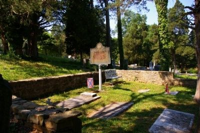
Grave of Gen. William Tatum Wofford Marker
GEOGRAPHIC SORT Title Sort Marker Number Sort Marker Number Sort N Marker Number Sort T Publication Order Sort Publication Order Sort A Erected Year Sort Most Viewed Sort Most Recent-Interest Sort Most Recently Changed Sort SEE FAQ #33 FOR DESCRIPTIONS
Near Cassville-White Road at Shinall Gaines Road NW.
On Joe Frank Harris Parkway (U.S. 41) at Cassville Road, on the right when traveling north on Joe Frank Harris Parkway.
On Joe Frank Harris Parkway (U.S. 41) 0.1 miles south of Willow Lane, on the right when traveling south.
On Joe Frank Harris Parkway (U.S. 41) at Willow Lane NW, on the right when traveling north on Joe Frank Harris Parkway.
On Fire Tower Road at Gaddis Road, on the right when traveling east on Fire Tower Road. Reported missing.
On Cassville Road NW (Old Route 41), on the left when traveling south.
On Old Allatoona Road at Allatoona Landing Road, on the left when traveling south on Old Allatoona Road.
On Main Street (Georgia Route 293) at Gaston Westbrook Avenue, on the left when traveling north on Main Street.
On North Main Street SE (Georgia Route 293) at Sandtown Road SE, on the right when traveling west on North Main Street SE.
On Covered Bridge Road SW, 0.1 miles west of Covered Bridge-Stilesboro Road SW, on the right when traveling west.
On Hall Station Road, 0.1 miles south of Old Hall Station Road, on the right when traveling south.
On East Railroad Street at Shaw Street, on the left when traveling west on East Railroad Street.
On Kingston Highway (Georgia Route 293) at Martin Circle, on the left when traveling west on Kingston Highway.
On Law Road, 1.2 miles north of Kingston Highway (Georgia Route 293), on the left when traveling north.
On West Main Street at Johnson Street, on the left when traveling east on West Main Street.
Paid Advertisement
On West Main Street at Elliott Street, on the right when traveling east on West Main Street.
On Euharlee Road at Macedonia Road, on the right when traveling west on Euharlee Road.
On Hall Station Road, 1.4 miles north of Kingston Highway (Georgia Route 293), on the left when traveling north.
On West Main Street at Church Street, on the right when traveling east on West Main Street.
On Johnson Street at West Main Street, on the left when traveling north on Johnson Street.
On Kingston Highway (Georgia Route 293) at Hall Station Road, on the right when traveling west on Kingston Highway.
On Johnson Street, 0 miles east of Cemetery Street, on the left when traveling south.
On Kingston Highway (Georgia Route 293) at Roberson Road, on the left when traveling west on Kingston Highway.
On Mount Pleasant Road, 1.7 miles Georgia Route 140, on the right when traveling north.
On Taff Road, 0.1 miles south of Rockmart Highway (Georgia Route 113), on the right when traveling south.
On South Sheridan Street south of East Central Avenue (U.S. 319), on the right when traveling north.
On West Central Avenue (U.S. 319) at North Grant Street (U.S. 129), in the median on West Central Avenue.
On West Suwanee Street, 0 miles west of North Gordon Street, on the left when traveling west.
On West Central Avenue (U.S. 319) at Grant Street (U.S. 129), in the median on West Central Avenue.
On Bethlehem Church Road, 0.1 miles south of Broom Road, on the left when traveling south.
On South Davis Street (U.S. 129) at East Washington Avenue, on the right when traveling north on South Davis Street.
Paid Advertisement
On North Main Street (U.S. 129) at Flat Creek Church Road, on the left when traveling north on North Main Street. Reported missing.
On South Davis Street (U.S. 129) at East Washington Street, on the right when traveling north on South Davis Street.
On North Davis Street (U.S. 129) at East Marion Street (Georgia Route 76), on the right when traveling north on North Davis Street.
Near Riverside Drive (U.S. 23) at Jones Street.
On Anthony Road at Stephens Street, on the right when traveling east on Anthony Road.
On Ocmulgee National Park Road, 0.2 miles Emery Highway (Georgia Route 80), on the right when traveling south.
On Mulberry Street at 2nd Street, on the right when traveling west on Mulberry Street.
On High Street, on the left when traveling east.
On Joe Tamplin Industrial Boulevard, 0.1 miles west of Riggins Mill Road, on the right when traveling west.
On Shurling Drive, 0 miles west of Gray Highway (U.S. 129), on the right when traveling west.
On Walnut Street, 0 miles east of 2nd Street, on the right when traveling east.
On D. T. Walton Sr. Way at Poplar Street on D. T. Walton Sr. Way.
On College Station Drive, 0 miles south of Columbus Road, on the right when traveling south. Reported missing.
Near Riverside Drive (U.S. 23).
On Vineville Avenue (U.S. 41) at Vista Circle, on the right when traveling north on Vineville Avenue.
On Willie Smokie Glover Drive, on the right when traveling west. Reported missing.
Paid Advertisement
On 3rd Street, 0 miles north of Cherry Street, in the median.
On Woolfolk Street at Smith Street, on the right when traveling west on Woolfolk Street.
Near Riverside Drive (U.S. 23) at Jones Street.
On Mulberry Street, 0 miles east of 2nd Street, in the median.
On Mulberry Street Parkway.
On Coleman Avenue at College Street, on the right when traveling east on Coleman Avenue.
On Mulberry Street at 1st Street, on the right when traveling west on Mulberry Street.
On College Street at Georgia Avenue, on the left when traveling north on College Street.
On Poplar Street at New Street, on the right when traveling east on Poplar Street.
On Ward Street, 0.1 miles north of Vineville Avenue (U.S. 41), on the right when traveling north.
On Ocmulgee National Park Road, 0.2 miles Emery Highway (U.S. 80), on the right when traveling south.
On Washington Avenue (U.S. 41) at High Place, on the right when traveling east on Washington Avenue.
On Mulberry Street at 1st Street, on the right when traveling east on Mulberry Street.
On Mulberry Street, 0 miles west of 1st Street, in the median.
On Mulberry Street, 0 miles west of New Street, in the median.
On Mulberry Street, 0 miles west of 3rd Street, in the median.
Paid Advertisement
On Golden Isles Highway (U.S. 23) 0.3 miles north of Coley Station Road (Georgia Route 112), on the right when traveling north.
On Longstreet Church Road, 0.5 miles south of Broadhead Road, on the left when traveling north.
On Dykes Street SE (Georgia Route 26) north of 8th Street SE, on the right when traveling north.
On U.S. 82, 0.4 miles west of Petty Crossing Road, on the right when traveling east.
On Main Street (U.S. 301) near Brantley Street, on the right when traveling north.
On Beasley Road (County Route 79) 0 miles Grooverville Road (County Route 275), on the left when traveling north.
Near Liberty Church Road (County Route 94) 0 miles north of Grooverville Road (County Route 275), on the right when traveling west.
On Campground Road, 0 miles east of Adel Highway (Georgia Route 76), on the left when traveling south.
On Adel Highway (Georgia Route 76) at Coffee Road, on the right when traveling north on Adel Highway.
On Radford Road (County Route 114) 0.8 miles west of Madison Highway (Georgia Route 333), on the left when traveling west.
On Bethel Church Road, 1.5 miles south of Georgia Route 122, on the left when traveling south.
On Bethlehem Church Road at Grooverville Road, on the left when traveling south on Bethlehem Church Road.
On East Screven Street (U.S. 84) at South Court Street (U.S. 221), on the right when traveling west on East Screven Street.
On South Court Street (U.S. 221) at West Screven Street (U.S. 84), on the right when traveling south on South Court Street.
On Moultrie Highway (Georgia Route 333) at Coffee Road, on the left when traveling south on Moultrie Highway.
Paid Advertisement
On Thomasville Road (U.S. 84) 0 miles west of South Laurel Street, on the right when traveling east.
On U.S. 80, on the right when traveling east.
On U.S. 80 near U.S. 280, on the right when traveling south.
On U.S. 280 at Black Creek Church Road, on the left when traveling south on U.S. 280.
On Belfast-Keller Rd, on the left when traveling west.
On South College Street (Georgia Route 67) near Courthouse Street, on the right when traveling north.
On Ford Avenue (State Highway 144) at Coastal Highway (U.S. 17), on the right when traveling east on Ford Avenue.
On U.S. 144 at State Road 67, on the left when traveling south on U.S. 144.
On Fort McAllister Road (State Highway 144 Spur) near Bryan Neck Road (State Highway 144), on the right when traveling east.
On Ford Avenue (State Highway 144) at Coastal Highway (U.S. 17), on the right when traveling east on Ford Avenue.
Near Fort McAllister Road.
Near Fort McAllister Road.
On State Highway 144 at County Route 67, on the right when traveling west on State Highway 144.
On Fort McAllister Road (State Highway 144 Spur) near Bryan Neck Road (State Highway 144), on the right when traveling east.
Near Fort McAllister Road.
On U.S. 301 at Adabelle Road, on the right when traveling south on U.S. 301.
Paid Advertisement
On Arcola Road (County Route 582) at McElveen Cemetery Road (County Route 327), on the left when traveling south on Arcola Road.
On Statesboro Highway (U.S. 301) near Old River Road North, on the right when traveling south.
On Old River Road North (County Route 474) at Jones Ln Memorial Highway (U.S. 301), on the right when traveling west on Old River Road North.
On Georgia Route 119 at Turner Road, on the left when traveling west on State Route 119.
On N. Main Street (U.S. 301) at Courtland Street, on the right when traveling south on N. Main Street.
2008 entries matched your criteria. Entries 101 through 200 are listed above.
⊲ Previous 100 —
Next 100 ⊳