2 entries match your criteria.
Related Historical Markers
By J. J. Prats, May 30, 2015
Great Eastern Divide Marker
SHOWN IN SOURCE-SPECIFIED ORDER
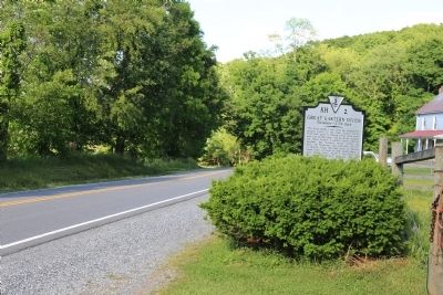
| On Cumberland Gap Road (Virginia Route 42) 8.2 miles west of New Castle, on the left when traveling west. |
| | This point marks a spot along the geographical feature known as the Great Eastern Divide. From here water of Sinking Creek flows southwest into the New River. The New River, probably the oldest stream in eastern North America, becomes the Kanawha . . . — — Map (db m84180) HM |
| On Sweet Springs Valley Road (West Virginia Route 3) 4.7 miles east of Gap Mills, on the right when traveling east. |
| | At this point atop the Alleghenies is the geographical feature known as the Great Eastern Divide, a natural barrier from which water flows to the Atlantic Ocean by way of the Jackson and James rivers and to the Gulf of Mexico via the Greebrier, New, . . . — — Map (db m62558) HM |
Jun. 26, 2024