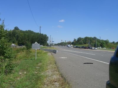
On Jefferson Davis Highway (U.S. 1) 0.1 miles south of Dale Blvd and Rippon Blvd, on the right when traveling south.
To the east is the only preserved segment of the Potomac Path, the earliest north-south route in northern Virginia. Following an ancient Indian trail, the road, later known as the King's Highway, assumed great importance for overland travel between . . . — — Map (db m2164) HM
On Forest Grove Drive at Rippon Boulevard (County Route 784), on the right when traveling north on Forest Grove Drive.
The Old Potomac Path
Originally an Indian Trail and traversed by early settlers, it later became the first coach and post road between Northern and Southern Colonies, and was called
The King’s Highway
General Washington often stopped . . . — — Map (db m241858) HM
On Forest Grove Drive at Rippon Boulevard (County Route 784), on the right when traveling north on Forest Grove Drive.
A Road to Rippon Lodge
Rippon Lodge Historic Site on Blackburn road has a long association with The King’s Highway. A segment of the road cut directly through the property when the Blackburn family lived there during the 18th century. The . . . — — Map (db m5975) HM
Near Forest Grove Drive north of Rippon Boulevard (Virginia Route 784), on the right when traveling north.
The King’s Highway was the first north-south route through Virginia. The road began in Boston and ended in Williamsburg. It may have followed one or more trails that American Indians used before European colonization.
The route was first . . . — — Map (db m5959) HM
On Frayley Boulevard (U.S. 1) north of Williamstown Drive, on the right when traveling north.
The roads through Prince William County were important routes for the Revolutionary War campaign of 1781. In April, the Marquis de Lafayette passed through the county on the King's Highway with a portion of Gen. George Washington's Continental Army. . . . — — Map (db m166461) HM
In the late 18th century, armies made the most use of the King’s Highway. Merchants preferred to move goods such as tobacco over the Potomac River since land travel was difficult. The road became a main transportation route after the . . . — — Map (db m4890) HM
The King’s Highway was the first north-south route through Virginia. The road began in Boston and ended in Williamsburg. It may have followed one or more trails that American Indians used before European colonization.
The route was first . . . — — Map (db m4891) HM
On Jefferson Davis Highway (U.S. Rt 1), on the right when traveling south.
In this vicinity stood Peyton’s Ordinary. George Washington, going to Fredericksburg to visit his mother, dined here, March 6, 1769. On his way to attend the House of Burgesses, he spent the night here, October 31, 1769, and stayed here again on . . . — — Map (db m2187) HM
On Jefferson Davis Highway (U.S. Rt 1), on the right when traveling south.
In 1664, a colonial road here probably followed the trace of an old Indian path. Two years later, the road was extended to Aquia Creek. It became a post road in 1750, and in Sept. 1781 Gen. George Washington passed over it on the march to Yorktown. . . . — — Map (db m2188) HM