By Steve Stoessel, June 12, 2023
Bike Path Trailhead on Pearl Street
GEOGRAPHIC SORT Title Sort Marker Number Sort Marker Number Sort N Marker Number Sort T Publication Order Sort Publication Order Sort A Erected Year Sort Most Viewed Sort Most Recent-Interest Sort Most Recently Changed Sort SEE FAQ #33 FOR DESCRIPTIONS
On South Pearl Street (New York State Route 32) 0.1 miles south of Kenwood Road, on the right when traveling north.
Near New Karner Road (New York State Route 155) at Old State Road.
On Knox Street Mall/Henry Johnson Boulevard just south of Washington Park Road, on the left when traveling south.
On Henry Johnson Boulevard at Washington Avenue, on the right when traveling east on Henry Johnson Boulevard.
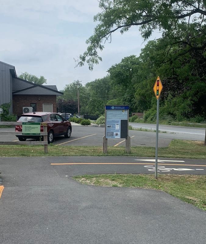
On Empire State Trail at NY Bike Routes 9 & 5 on Empire State Trail.
On Eagle Street at Pine Street on Eagle Street.
Near Madison Avenue (U.S. 20) at New Scotland Avenue.
Near Washington Park Road, 0.1 miles east of New Scotland Avenue, on the left when traveling east.
On New Scotland Avenue (Washington Park Road) at Madison Avenue (U.S. 20), on the right when traveling north on New Scotland Avenue (Washington Park Road).
On Clinton Avenue at Manning Boulevard, on the left when traveling south on Clinton Avenue.
On Main Street (New York State Route 156) at Maple Avenur (New York State Route 146), on the left when traveling west on Main Street.
On Delaware Avenue, on the left when traveling north.
On Delaware Avenue, on the left when traveling north.
On Delaware Avenue, on the left when traveling north.
Paid Advertisement
On Delaware Avenue, on the left when traveling north.
On River Road, 0.2 miles west of Forts Ferry Road, on the right when traveling east.
Near West Poplar Drive east of Elsmere Avenue (New York State Route 335).
On Empire State Trail south of Fourth Street, on the right when traveling south.
On River Road (New York State Route 144) 0.1 miles south of Simmons Road, on the right when traveling north.
On Kenwood Avenue, 0.1 miles east of New Scotland Avenue (New York State Route 85), on the right when traveling west.
On Kenwood Avenue, 0.1 miles east of New Scotland Avenue (New York State Route 85), on the right when traveling west.
On Grove Street at South Main Street, on the right when traveling east on Grove Street.
On New York State Route 19 at Leonard Ave, on the right when traveling south on State Route 19.
Near Bronx Park Road, 1 mile south of East Fordham Road (U.S. 1), on the right when traveling south.
Near Jungle World Zoo, 0.1 miles Bronx River Parkway, on the right when traveling west.
Near Bronx Park Road south of East Fordham Road (U.S. 1), on the left when traveling south.
Near Jungle World Road south of Bronx River Parkway, on the right when traveling south.
Near Bronx Park Road south of East Fordham Road (U.S. 1), on the left when traveling south.
Near Bronx Park Road south of East Fordham Road (U.S. 1), on the right when traveling south.
Near Bronx Park Road south of East Fordham Road (U.S. 1) when traveling south.
Paid Advertisement
Near Jungle World Road south of Bronx River Parkway, on the right when traveling south.
Near East 161 Street west of Grand Concourse, on the right when traveling west.
Near East 161 Street west of Grand Concourse, on the right when traveling west.
On Bartow Avenue, 0.2 miles east of Co-Op City Boulevard, on the right when traveling west.
On East 161 Street at Jerome Avenue, on the right when traveling west on East 161 Street.
On Jerome Avenue north of East 164th Street, on the right when traveling north.
On West 230th Street at Marble Hill Avenue, on the left when traveling west on West 230th Street.
On East 163rd Street east of Melrose Avenue, on the right when traveling east.
On East 161st Street west of Courtlandt Avenue, on the right when traveling west.
Near East 140th Street just west of Brook Avenue, on the left when traveling east.
On Grand Concourse south of East 149th Street, on the right when traveling south.
On Saint Ann's Avenue at East 139th Street, on the right when traveling south on Saint Ann's Avenue.
On East 135th Street just west of Willis Avenue, on the right when traveling west.
On East 140th Street just west of Brook Avenue, on the right when traveling east.
On Mosholu Avenue at West 254th Street, on the left when traveling north on Mosholu Avenue.
On Hugh J. Grant Circle at Metropolitan Avenue on Hugh J. Grant Circle.
Paid Advertisement
Near Bruckner Boulevard north of Middletown Road, on the right when traveling north.
Near Charles J. Cimi Place east of Westchester Avenue, on the right when traveling north.
Near Exterior Street, 0.3 miles north of East 150th Street, on the right when traveling south.
Near North Shore Drive at Water Street.
Near North Shore Drive at Water Street.
On Conklin Avenue at Exchange Street, on the left when traveling east on Conklin Avenue.
Near Camp Allegany & Bova Cottages Road, 0.2 miles east of ASP Route 2.
Near Allegnay State Park Route 3, 0.8 miles east of Allegany State Park Route 1.
On France Brook Road, 0.8 miles west of ASP 2, on the right when traveling west.
Near Allegany State Park Route 1,, 2 miles north of Allegany State Park Route 3.
On Stone Tower Road, 0.5 miles west of Route ASP 1, on the left when traveling west.
On Allegany State Park Route 1, 1 mile north of Stone Tower Road, on the right when traveling north.
On South Street (New York State Route 34) south of Grover Street, on the right when traveling south.
On Cayuga Street (New York State Route 90) at Chapel Street, on the right when traveling south on Cayuga Street.
Near Chautauqua Avenue (New York State Route 430) at Creek Road, on the right when traveling south.
On Curtis Street Extension, 1.2 miles north of Durant Avenue, on the right when traveling north.
Paid Advertisement
On East Lake Road (New York State Route 5) 0.2 miles east of North Portage Road (New York State Route 394), on the right when traveling west.
On New York State Route 23 at Benedict Hill Road, on the right when traveling east on State Route 23.
Near Mace Chasm Road at U.S. 9, on the left when traveling west.
Near Mace Chasm Road at U.S. 9, on the left when traveling west.
Near Mace Chasm Road at U.S. 9, on the left when traveling west.
On Mace Chasm Road near U.S. 9, on the left when traveling west.
Near New York State Route 344, 0.5 miles east of Valley View Road.
On Harlem Valley Rail Trail at Under Mountain Road, on the left when traveling north on Harlem Valley Rail Trail.
On New York State Route 344 east of Miles Road, on the right when traveling east.
On Valley View Road, on the right when traveling east.
Near Taconic State Park, 0.5 miles north of New York State Route 344, on the left when traveling east.
Near Clermont Avenue, 0.3 miles west of Woods Road (County Route 35).
Near Clermont Avenue, 0.3 miles west of Woods Road.
Near Olana State Historic Site, on the right when traveling north.
On Warren Street at Park Place, on the right when traveling west on Warren Street.
Paid Advertisement
On Broad Street (U.S. 9) at Hudson Street (County Route 21), on the right when traveling north on Broad Street.
On Ice House Road, 0.3 miles west of New York State Route 9J, on the left when traveling west.
On Albany-Hudson Electric Trail north of Electric Park Road, on the right when traveling south.
Near County Route 25A, 0.5 miles north of New Road (County Route 25A).
On New Street (County Route 25A) at Woods Lane, on the right when traveling north on New Street.
On New Street (County Route 25A) at Woods Lane, on the right when traveling north on New Street.
On Albany-Hudson Electric Trail south of Main Street (County Route 28), on the right when traveling south.
On New York State Route 281 south of Clinton Street, on the right when traveling south.
Near River Street south of Patterson Street, on the right when traveling south.
On New York State Route 23, on the right when traveling west.
On River Road, on the right when traveling south.
On Van Dam Road east of Albany Post Road (New York State Route 9), on the right when traveling east.
On Van Dam Road east of Albany Post Road (New York State Route 9), on the right when traveling east.
Near Van Dam Road east of Albany Post Road (New York State Route 9), on the right when traveling east.
On New York State Route 55 & 22, 0.4 miles north of N Quaker Hill Road, on the right when traveling south.
Near Parker Avenue (New York State Route 9G) 0.2 miles east of Washington Street (New York State Route 9G), on the left when traveling east.
Paid Advertisement
Near North Water Street, 0.3 miles north of Main Street, on the left when traveling north.
Near Parker Avenue (New York State Route 9G) 0.2 miles east of Washington Street (New York State Route 9G), on the left when traveling east.
On New York State Route 9G south of Wurtemburg Road, on the right when traveling south.
Near Wheeler Hill Road south of Carnwath Farms Lane, on the right when traveling south.
Near Wheeler Hill Road at Carnwath Farms Lane, on the right when traveling south.
813 entries matched your criteria. The first 100 are listed above.
Next 100 ⊳