On Funston Avenue at Lincoln Boulevard, on the right when traveling south on Funston Avenue.
Formally established on September 17, 1776, the San Francisco Presidio has been used as a military headquarters by Spain, Mexico, and the United States. It was a major command post during the Mexican War, Civil War, Spanish-American War, World Wars . . . — — Map (db m10743) HM
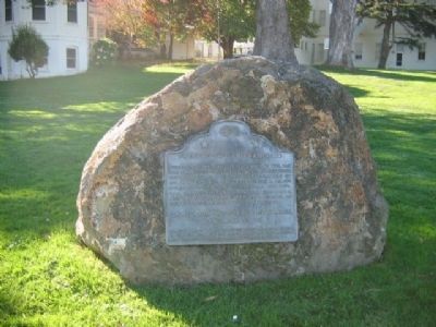
On Beale Street at Bryant Street, on the right when traveling east on Beale Street.
A fashionable neighborhood in the 1860s, Rincon Hill was the home of
William Tecumseh Sherman, William C. Ralston, William Gwin, H. H.
Bancroft, and others. By the 1880s the hill, already partially leveled,
became a working class district. Today . . . — — Map (db m135535) HM
On Seacliff Avenue near End of Seacliff, on the right when traveling west.
Since Gold Rush times, this cove was used as a campsite by many of the Chinese fishermen who worked in and around San Francisco Bay. Their efforts to supply the needs of a young city helped establish one of the area's most important industries and . . . — — Map (db m52925) HM
On Point Lobos Avenue west of El Camino del Mar/48th Avenue.
The two-masted, 148-ton Parallel left San Francisco for Astoria, Oregon, with a mixed cargo & 42 tons of black powder & dynamite. Capt. W.C. Miller, fought against difficult winds for two days & finally gave up. The abandon-ship order put the 7-man . . . — — Map (db m48586) HM
On Green Street. near Sansome Street, on the right when traveling west.
In a simple laboratory on this site, 202 Green Street, Philo Taylor Farnsworth, U.S. pioneer in electronics,invented and patented the first operational all-electronic "television system" on September 7, 1927. The 21 year-old inventor and several . . . — — Map (db m20900) HM
Nineteen tablets embedded in the sidewalk line each side of Castro Street between Market Street and 19th Street.
Before 1776 The native Yelamu people live nearby in the village of Hutchuei, relocating each winter to the bayside . . . — — Map (db m99828) HM
On East L Street at 7th Street, on the right when traveling east on East L Street.
Called Wilson’s Station
From 1849 until 1869
Was given the name by Leland Stanford when he moved his Central Pacific Railroad terminal here and dedicated the town to his wife’s family. In 1886, after a dispute with local citizens, Stanford . . . — — Map (db m20006) HM
On North Stockton Street at East Elm Street, on the right when traveling north on North Stockton Street.
Lodi's first park, 1876,
called Wardrobe Grove
Later named for Frank Hale, our 2nd mayor
Municipal baths with hot artesian well, 1916
Petrified tree from San Joaquin & Sierra
Nevada rail bed near Valley Springs, 1920
The bandstand . . . — — Map (db m41476) HM
In August 1844, the first settlers arrived at Rancho del Campo de los Franceses. One of the company, Thomas Lindsay, built the first dwelling, a tule hut, on this site. He was later murdered by Indians and buried here by travelers. The Point was . . . — — Map (db m15964) HM
On East Magnolia Street at North San Joaquin Street, on the right when traveling east on East Magnolia Street.
Stockton’s first historic district has the community’s richest variety of architectural styles, including Queen Anne, Eastlake, Stick, Bungalow, Craftsman, Moderne and Spanish Revival. Since the 1860’s the area has been home to a broad cross . . . — — Map (db m15985) HM
Stockton was built on land granted by the Mexican government on January 13, 1842, to German-born Charles M. Weber and his business partner and Mexican citizen, William Gulnac. Weber later became sole owner of the land, permanently settling here two . . . — — Map (db m24233) HM
Built through subscription by the residents of Woodbridge and dedicated as Woodbridge Seminary in 1879 by the United Brethren Church, this was the site of San Joaquin Valley College from 1882 to 1897. It was then used as Woods Grammar School until . . . — — Map (db m15990) HM
On West Mall near El Camino Real, on the right when traveling east.
Inspired by “The Grand Basin” at the 1904 St. Louis World’s Fair, Atascadero founder E.G. Lewis envisioned a formal Sunken Garden to adorn the civic center in his new colony. Restored in 2005 as originally designed with walkways crossing the . . . — — Map (db m249447) HM
Near Elkhorn Road, 4.5 miles south of California Route 58.
Welcome to Wallace Creek. Yes, you are looking at a creek. Wallace Creek may seem insignificant compared to other streams or rivers, after all, on most days of the year, it is bone dry. But it tells an important and exciting story.
As you can . . . — — Map (db m126611) HM
On Old Creamery Road west of Harmony Valley Road, on the right when traveling west.
....grew up around a dairy, founded in 1869. Until 1907 the creamery changed hands several times. In these early days rivalries and feuding among the dairy farmers caused chaos in the valley. After one shooting death a truce was called. All agreed . . . — — Map (db m68508) HM
Mayor Pro Tem Erik Howell
Council Member Sheila Blake
Council Member Marcia Guthrie
Council Member Mary Ann Reiss
Downtown Pismo Beach began in 1881 with a wharf and hotel on Main Street as founder john Price mapped the city’s first . . . — — Map (db m225442) HM
A Spanish mission founded by Fray Junipero Serra, O.F.M., First president of the California missions. This was the fifth in a chain of 21 missions stretching from San Diego to Sonoma. Built by the Chumash Indians living in the area. Its combination . . . — — Map (db m27237) HM
This imposing building is an excellent example of California Mexican Era architecture. Using Indian labor, Petronilo Rios built the two-story Adobe about 1846 as his residence and headquarters for sheep and cattle operations. Named "Caledonia" in . . . — — Map (db m68935) HM
On Pozo Road east of Forest Route 30S05, on the right when traveling west.
In the 1850's Ynocente Garcia and sons recorded claims for the Rancho San Jose which included today's Pozo. In 1878, the area's first postmaster, George Lingo, was refused the name San Jose for the post office and accepted Pozo (Well - in Spanish) . . . — — Map (db m101109) HM
On Hillcrest Drive west of Mission Street (California Highway 82), on the right when traveling east.
Near this site from 1868-1907 was the 250 acre San Mateo dairy ranch operated by pioneer resident John Daly, for whom Daly City was named upon incorporation of the city in 1911. Among his philanthropic gestures was the opening of his Daly’s Hill . . . — — Map (db m52311) HM
This Property Has Been
Placed On The
NATIONAL REGISTER
OF HISTORIC PLACES
By The United States
Department Of The Interior
National Register of Historic Places Statement of Significance:
Building/structure dates: 1890 initial . . . — — Map (db m12539) HM
This structure, built by Felix Buelna in the 1850s, served as a gambling retreat and meeting place for Mexican-Californios. It was strategically located on the earliest trail used both by rancheros and American settlers crossing the peninsula to the . . . — — Map (db m11992) HM
On Marshall Street at Hamilton Street, on the left when traveling east on Marshall Street.
This was a public plaza in the Mezesville townsite, and was a park until 1959 when it was given to San Mateo County for a Hall of Justice and Records. — — Map (db m62577) HM
On Hamilton Street at Marshall Street on Hamilton Street. Reported unreadable.
California Square was a parcel of land located north of Marshall Street, between Hamilton and Winslow, diagonally located across the street from the Courthouse. The site was originally designated as a public park plaza in the Town of Mezesville . . . — — Map (db m202534) HM
On Broadway east of Jefferson Avenue, on the right when traveling east.
You are standing over what was once Redwood City’s original waterfront, made up of creeks, tidal basins, and a fresh-water slough, providing the start of lumber, shipping and shipbuilding trades for the area. The tidal basins south of Bradford . . . — — Map (db m62622) HM
Near Tanforan Way east of El Camino Real, on the right when traveling east.
This garden memorializes a time when this site, then the Tanforan Park Racetrack, was transformed into a temporary assembly center for persons of Japanese ancestry. On February 19, 1942, in the absence of charges or due process of law, President . . . — — Map (db m165488) HM
Near El Camino Real (State Highway 82) at San Carlos Avenue.
Southern Pacific constructed this station in 1888 to meet the needs of the new town of San Carlos. The use of the Richardsonian Romanesque Revival style of architecture was exceedingly rare for railroad depots in California. This style and the use . . . — — Map (db m11041) HM
The site of the Central Park is possibly the sole surviving example of the late nineteenth century estates once so numerous on the Peninsula.
Charles B. Polhemus, Director of the San Francisco & San Jose Railroad and founder of Central San . . . — — Map (db m28712) HM
On El Camino Real (Highway 82) south of Baywood Avenue, on the right when traveling south.
Here stood the MISSION HOSPICE built around 1800 by the Spanish Padres on El Camino Real to break the journey from Santa Clara and serve the Indians of Mission Dolores. — — Map (db m18417) HM
On South B Street at 2nd Avenue, on the right when traveling north on South B Street.
Originally, Michael Carey’s brick store, 1875 – later acquired by A.T. Bartlett and G. Fisher. C. M. Morse’s Drug Store, also Fisher Hotel. First San Mateo telephone, 1883. First San Mateo Fire Department organized here, 1887.
Strebel . . . — — Map (db m29548) HM
There are few traces left of
San Mateo’s First Residents
Before the Europeans arrived, Native Americans living in the San Mateo area were known as the Salson. The Salson have been grouped with the Ohlone or Costanoan people. The Salson . . . — — Map (db m29549) HM
On Portola Road, 0.2 miles east of Woodside Road (SR84), on the left when traveling east.
About three hundred feet south of this monument on the banks of Alambique Creek, stood San Mateo County's first saw mill. Built by Charles Brown in 1847. About the same time Dennis Martin was building a second mill on San Francisquito Creek. Both . . . — — Map (db m18478) HM
On Santa Barbara Street north of East De La Guerra Street, on the right when traveling north.
This tablet marks the southeasterly boundary of the Santa Barbara Presidio founded in 1782 by Gov. Felipe de Neve and Capt. Jose Francisco Ortega in command of fifty soldiers accompanied by Fray Junipero Serra who dedicated the site. — — Map (db m128224) HM
∙∙∙Known as the El Embarcadero de Santa Clara in pre-American days. ∙∙∙Was the port of entry for San Jose prior to the coming of the railroad. ∙∙∙Surveyed and platted by C.S. Lyman in . . . — — Map (db m24342) HM
On Elizabeth Street at Hope Street, on the right when traveling west on Elizabeth Street.
This building served as lodging for many Bayside Cannery workers who normally lived in San Francisco or other distant cities. In addition to dorm rooms, the building also contained a kitchen and dining hall. During the cannery’s operation, this . . . — — Map (db m24367) HM
Alviso’s marina today starkly contrasts with its past as a bustling seaport. In the mid-19th century, Alviso was a transportation hub through which crops, goods and people circulated, fueling the economic growth of the South Bay. Port activity in . . . — — Map (db m24408) HM
On El Dorado Street, on the left when traveling south.
Harry George Wade’s Warehouse was originally used to store hay and grain bound for San Francisco. It was later used to store stagecoaches for the Alviso to Monterey stage lines. In addition to being used by Wells Fargo and Company for stagecoach . . . — — Map (db m24452) HM
On Catherine Street, on the right when traveling west.
Originally built as a private home, the house was remodeled in 1904 to serve as a boarding house for PG&E employees. It was later purchased by William Clampett and Jane Huxham in the 1920s. During the 1940s, boat restoration work for PG&E was . . . — — Map (db m24450) HM
Because of its location at the mouth of the Guadalupe River, Alviso was deemed the ideal location for a seaport. In the 1830s and 40s, it was the only port where raw materials and crops could be shipped from the Santa Clara Valley to San Francisco. . . . — — Map (db m24429) HM
The Santa Clara County Parks and Recreation Department and the Santa Clara Valley Water District dedicated the Alviso Marina County Park on September 24, 2005.
First known to the Ohlone Indians, the lands of The Alviso Marina County Park . . . — — Map (db m24407) HM
Black Walnut Trees planted about 1885 by William A. Swope, Son-In-Law of Benjamin Campbell, and daughters Alda Swope Blaine, Ethel Swope Davis, and Lena Swope French. — — Map (db m24234) HM
Near Watsonville Road at Burchell Road, on the right when traveling west.
[This is a two-sided marker. Side-one being in English and Side-two being in Spanish:][Side One:]
CHITACTAC
For over 3,000 years, this area around the Uvas Creek drainage supported large populations of ancestral Ohlone People. . . . — — Map (db m18508) HM
John Gilroy arrived in Monterey in 1814 on one of the North-West Co.
trading ships; "ISAAC TODD," which he deserted. He then fled to the Santa Clara Valley, marrying Maria Clara Ortega and settling on Rancho San Ysidro. His rightful name was John . . . — — Map (db m112025) HM
On Pacheco Pass Highway (State Highway 152) 1.8 miles east of State Highway 101, on the right when traveling east.
This base is a two-sided monument commemorating both Rancho San Ysidro (side 1) and San Ysidro School (side 2)
Rancho San Ysidro
In the early 1800's Rancho San Ysidro was granted to Ygnacio Ortega. After his
death the lands were . . . — — Map (db m18484) HM
This photo taken from Nob Hill, shows the emerging township of Burnett, and documents the early development of the downtown section of what we now call Morgan Hill. Already gone are manu of the native oak trees, harvested as fire wood for San Jose. . . . — — Map (db m212847) HM
Marker One:
Rancho Ojo de Agua de la Coche granted to Juan Maria Hernandez
Marker Two:
1845
Rancho Ojo de Agua de la Coche conveyed to Murphy family — — Map (db m213068) HM
On El Camino Real (State Highway 82), on the right when traveling south.
Long before Stanford University and the City of Palo Alto existed, this area of the Mexican land grant, Rancho Rincon de San Francisquito Creek was a crossroads of travel and commerce. In the 1850's, it would take Juana Briones three days to travel . . . — — Map (db m90886) HM
The nearby Bailey Fellows house is a historic “Italianate” structure located at the south end of Calero Reservoir and appears on the County of Santa Clara Heritage Resource Inventory. The house is named for Boargenes R. Bailey and Judge . . . — — Map (db m53474) HM
Built in 1854 of adobe, brick and wood. Residence of Mines Managers until 1925. Most gracious & stately California Mansion of early days. Scene of important social & political events. Planned by Henry W. Halleck & built by J. Young & F. Meyer. . . . — — Map (db m15046) HM
New Almaden Quicksilver Mine has been designated an historical landmark by American Society for Metals. Discovered in November 1845, it was the first workable quicksilver mine in North America and preceded the Coloma Gold Discovery of January 1848 . . . — — Map (db m15055) HM
Near Alum Rock Road, on the left when traveling east.
Alum Rock Park was acquired in stages over many years. The original claim is based on the first land grant by Governor Filipe de Neve, July 22, 1778. Alum Rock Park has survived many challenges to that original grant and on March 13, 1872 the . . . — — Map (db m63788) HM
On South Market Street at West Santa Clara Street, on the right when traveling south on South Market Street.
When completed in 1881, the 237-foot electric light tower that once spanned the intersection of Market and Santa Clara Streets was the largest single source of electric light in the country. The brainchild of J.J. Owen, founder of the San Jose . . . — — Map (db m31114) HM
St. James Park and its environs were the heart of nineteenth century San Jose. While the Plaza has been the center of the older Hispanic settlement, St. James Park and its surrounding buildings reflect the aspirations of an emerging American city. . . . — — Map (db m52561) HM
On Monterey Road at San Martin Avenue, on the right when traveling south on Monterey Road.
Martin Murphy, A native of Ireland, and
his large family came to California in
1844 and settled on the San Francisco de
Las Llagas Grant, which was patented
to Daniel Murphy, one of his sons. As a
devout Roman Catholic, Martin . . . — — Map (db m18479) HM
This site is what remains of the original Mission Santa Clara corral, which once covered about 6 acres and was enclosed by an adobe wall.
In 1847, marking the transition from Spanish/Mexican mission to American town, William Campbell mapped the . . . — — Map (db m52900) HM
On Jackson Street south of Benton Street, on the left when traveling south.
[There is no inscription on this maker other than the title. The marker consists of three panels of photographs with captions.][Panel 1:]
Photo 1 - Upper Left:
Franklin and Main Streets formed the business hub of early . . . — — Map (db m52865) HM
On El Camino Real near Palm Drive, on the right when traveling south.
Founded in 1777, the Santa Clara Mission was moved here after flooding of the first two churches. Construction was begun in 1781 under Jose Murguia and the Mission was dedicated by Junipero Serra in 1784.
The adobe structure was damaged by an . . . — — Map (db m24313) HM
On Main Street (State Highway 152) south of East/West Lake Street, on the right when traveling south.
Watsonville, where strawberries are sweeter, apples are crisper and produce plentiful, is a friendly place of diverse people who share a strong sense of community and optimism.
Don Sebastian Rodriquez owned the grant, Bolsa de Pajaro, on which . . . — — Map (db m54880) HM
On McArthur Road, on the right when traveling north.
In Commemoration of
Fort Crook
Established July 1, 1857 by Lieut' George Crook and Command for the protection of the immigrants and settlers. Later occupied by Capt John W Gardner and Capt McGregor.
The boundaries of this fort were . . . — — Map (db m143473) HM
On McArthur Road (State Highway 299), on the left when traveling east.
Established by Samuel Lockhart in 1856 as a link in the first wagon road from Yreka to Red Bluff, the Lockhart Ferry crossed below the confluence of the Fall and Pitt Rivers near this spot. After a massacre in December 1856, the ferry was . . . — — Map (db m10292) HM
Founded nearby by French miners in 1849, the town of Morrowville, relocated here, was the center of one of the state's richest gold producing areas. Total production was over $20,000,000. One of California's first stamp mills operated at the nearby . . . — — Map (db m57823) HM
In 1868, near this spot, the first school in Fall River Valley was built. The building was of log construction, 20 feet by 30 feet, with no floor or windows. About 1870 the first sawmill in the valley was built at Dana where lumber was obtained to . . . — — Map (db m57827) HM
On Diggles Street at Main Street on Diggles Street.
This land of ‘Siskiyou’...
‘Beaver Valley'...
“Rough and Ready”...
‘Aetna Mills’... ‘Etna’...
many names – but
One land of majestic mountains, pristine rivers & lakes. Sparkling streams flow through meadows filled . . . — — Map (db m57946) HM
The first stone fortress in the far west. Originally had two towers, but following an accidental explosion in 1912, it was rebuilt with only one tower and the present clock was installed. During the building’s history, it has served as a chapel, . . . — — Map (db m16305) HM
Erected in 1852, this historic building was ostensibly intended for Benicia City Hall, offered as the State Capitol and promptly accepted, it had that honor from February 4, 1853 to February 25, 1854. Deeded to state in 1951, it was one of the four . . . — — Map (db m16375) HM
[Marker mounted on front of base (Photo #1]
The birthplace of Mills College, founded in 1852 as the Young Ladies' Seminary of Benicia. Acquired from Mary Atkins by Cyrus and Susan Mills in 1865. It was moved to its present site in Oakland . . . — — Map (db m16312) HM
In 1882, Mathew Turner of San Francisco relocated his shipyard to Benicia. Turner, the most prodigious shipbuilder in North America, constructed 228 vessels, 169 of which were launched here. In 1913, the shipyard was purchased by James Robertson, . . . — — Map (db m31007) HM
On Silveyville Road at Schroeder Road, on the left when traveling west on Silveyville Road.
The village of Silveyville was first settled by Elijah F. Silvey in 1852. Silvey built a halfway house and stock corral for travelers going from San Francisco or Benicia to Sacramento. A post office was established in 1854, along with stores, a . . . — — Map (db m29955) HM
On Suisun Valley Road, on the left when traveling north.
Erected by pioneers of Methodist Episcopal Church South with volunteer labor and donated funds. Cornerstone laid October 3, 1856. Dedicated February 1857. Site supplied by Landy and Sandy Alford. Chapel deteriorated by 1929 and deeded by the church . . . — — Map (db m16294) HM
On Mankas Corner Road at Clayton Road on Mankas Corner Road.
This site was originally constructed in 1860 as the Suisun Valley General Mercantile & original Pony Express station.
The Vezer Family provides this facility for the enjoyment of the families of this wonderful valley and gives special . . . — — Map (db m25058) HM
On Merchant Street at Main Street, on the right when traveling north on Merchant Street.
[Front of Marker:]
IN SEARCH OF THE PONY EXPRESS
STATION MARKER
Dedicated April 23, 1997
GILLESPIE’S STORE
Added Station
Apr 23, 1860 – Sep 8, 1861
by
Dave & Buff Fleming
American Honda Motor Co., Inc.
Vacaville . . . — — Map (db m16833) HM
On Merchant Street at Main Street when traveling north on Merchant Street.
On this site once stood a two-story wooden structure built by E. F. Gillespie. It served as his general merchandise store until 1863. The Masonic Lodge was headquartered upstairs. The building was removed in 1897. — — Map (db m16838) HM
On North Cloverdale Boulevard (Highway 101), on the right when traveling south.
Gould-Shaw House
Thomas Jefferson Gould, an Indiana born blacksmith, built this house, which has become an important part of the town’s history, in 1862. One of the few surviving examples of Gothic Revival architecture, the house is the oldest . . . — — Map (db m109979) HM
Cotati's hexagonal town plan, one of only two such in the United States, was designed during the 1890s by Newton Smyth as an alternative to the traditional grid land planning. The six-sided town plaza was designed for founder Thomas Page, and each . . . — — Map (db m11998) HM
Jack London, noted writer, traveler and lecturer, occupied these premises from 1905 to 1916. Born San Francisco, January 12, 1876, died here November 22, 1916
“The Valley of the Moon” one of his best known books, is descriptive of this valley — — Map (db m176140) HM
Near Highway 1 near Fort Ross Road, on the left when traveling north.
Founded 1812 by Russians from Sitka. When Russians withdrew to Alaska, 1841, Captain Sutter bought the improvements and supplies. Acquired by State in 1906 and remaining buildings restored - Greek Orthodox Chapel, Commandants Quarters and Stockade. . . . — — Map (db m68792) HM
On Lakeville Highway, 1.1 miles south of Stage Gulch Road (California Route 116), on the right when traveling south.
There was once a large lake in the valley to the east. Early Indian settlers called it Lake Tolay, after their former chief; hence the name Lakeville for the community that developed on this site. The first boat landing was built in 1853. Passengers . . . — — Map (db m199977) HM
A short distance down-stream from this spot, at the head of navigation on the banks of Sonoma Creek, an early landing place was established. From the 1830’s hides and tallow from the Pueblo of Sonoma were shipped to Yerba Buena , and goods and . . . — — Map (db m78551) HM
The Mission Trail marked the three hundred years of Spanish-Mexican settlement. It travelled as far south as Guatemala and traversed Mexico to advance through eleven of our present day United States. In 1823 Mission San Francisco Solano was founded, . . . — — Map (db m15294) HM
On Arnold Drive (California Route 121), on the right when traveling south. Reported permanently removed.
At this site, on July 4, 1823 Father Altimra set up a Camp Alter and planted the Holy Cross. The troops fired a volley, and the Padre sang in adoration of the cross. A Mass was celebrated in gratitude, and the place was named San Francisco Solano. . . . — — Map (db m15317) HM
Original construction of store, library and dwelling which forms nucleus of this building in 1852 by Nathansons on land previously owned by Vallejo, this property was leased by Leiding to McKeague in 1877 and remodeled to become Eureka Hotel. 1886 . . . — — Map (db m15287) HM
Trinity traces its origins to St. Mary’s Hall, an Episcopal school for girls, established on the plaza by the Rev. John Leonard Ver Mehr on September 1, 1853, at the invitation of Sonoma founder Mariano Guadalupe Vallejo. During the next several . . . — — Map (db m15254) HM
Near East Napa Street (State Highway 12) west of First Street East, on the right when traveling west.
Has been designated a
Registered National Historic Landmark
Under the provisions of the Historic Sites Act of August 21, 1935 this site possesses exceptional value in commemorating and illustrating the history of the United States
U.S. . . . — — Map (db m231573) HM
On Sante Fe Avenue near Yosemite Boulevard (California Route 132), on the left when traveling south.
1 mile south of this spot is the site of Empire City. Founded 1850 by John G. Marvin . Head of navigation on the Tuolumne River, military supply depot and 2nd county seat of Stanislaus County. Destroyed by flood in 1861 – 62.
Dedicated Oct. . . . — — Map (db m19453) HM
Near First Street near Yosemite Boulevard (California Highway 132).
Two miles south of this spot was the site of “Empire City,” located on the south bank of the river. Founded in 1850 by John C. Marvin. The town was head of navigation on the Tuolumne River. It was a military supply depot for Forts Miller . . . — — Map (db m20210) HM
On Main Street-Sonora Road at Dean Street, on the right when traveling west on Main Street-Sonora Road.
Founded in 1852. This grocery store has been in continuous operation sever since. Making it the oldest store of its kind in the state of California. It has survived several disastrous floods that struck this community. The old pot bellied stove at . . . — — Map (db m12932) HM
The Hook and Ladder Fire Wagon was purchased in New York, by Knights Ferry and shipped around the Horn. Arriving in San Francisco in 1872. On arrival it was “claimed” by a S.F. Fire Company. A delegation from Knights Ferry liberated the . . . — — Map (db m12945) HM
On California Route 120, 0.3 miles east of Sonora Road, on the right when traveling west.
Picturesque mining center and trading post, 1849, once called Dentville. Early ferry to the southern mines; county seat 1862-72; rare wooden covered bridge reputedly designed by U. S. Grant, brother-in-law of the Dent brothers, 1854; old flour mill, . . . — — Map (db m178065) HM
On G Street at 11th Street, on the right when traveling east on G Street.
“A neon drive-in casts long shadows across a vast parking lot as the sun drops behind a distant hill. A large neon sign buzzes in the foreground of MEL’S DRIVE-IN, while in the background, “Rock Around The Clock” blares from the radio of a beautiful . . . — — Map (db m223768) HM
Originally called “Ralston” after the
founder who was too modest to permit
the use of his name, hence “Modesto”
Adamsville – 1854, Named after Doctor Adams, the only physician in the area.
Empire City – . . . — — Map (db m19506) HM
On Scenic Drive, on the right when traveling west.
The first recorded burial here was in 1860, but oral history says there were burials as early as 1850. Veterans of wars and conflicts since the Civil War are also buried here. In 1890 a wooden sidewalk was built from downtown so that the ladies’ . . . — — Map (db m19458) HM
On Tulare Street, on the right when traveling east.
On April 28, 1888 Simon Newman and the SP ran a special train from Oakland to bring potential land purchasers and investors. These were joined by the residents of Hills Ferry and the surrounding area. All who gathered enjoyed a huge barbecue and . . . — — Map (db m69132) HM