6981 entries match your criteria. Entries 101 through 200 are listed.⊲ Previous 100 — Next 100 ⊳
Charity & Public Work Topic
By James Hulse, June 17, 2024
Civilian Conservation Corps (The CCC) Marker
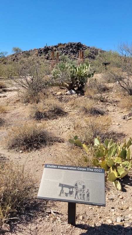
| 101 ► Arizona, Pima County, Tucson — Civilian Conservation Corps (The CCC) — |
| On Signal Hill Road north of Golden Gate Road. | |||
| 102 ► Arizona, Pima County, Tucson, Barrio Viejo — Temple Emanu-El — |
| On South Stone Avenue, on the right when traveling south. | |||
| 103 ► Arizona, Pinal County, Apache Junction — Roosevelt Dam — 1903-1911 — Tonto National Forest — |
| Near The Apache Trail (Arizona Route 88 at milepost 241). | |||
| 104 ► Arizona, Pinal County, Apache Junction — Superstition Mountain Historical Society — |
| On East Apache Trail (Arizona Route 88 at milepost 199), on the right when traveling east. | |||
| 105 ► Arizona, Pinal County, Florence — Florence Town Hall / Police and Fire Department — |
| On North Main Street north of 12th Street, on the left when traveling north. | |||
| 106 ► Arizona, Pinal County, Florence — George-Brockway House — Historic Site — |
| On South Central Avenue, on the right when traveling north. | |||
| 107 ► Arizona, Yavapai County, Sedona — Sedona Fire & Police Departments — Historic Sedona — |
| Near Hwy 89A. | |||
| 108 ► Arkansas, Benton County, Rogers — Historic Rogers Post Office Building — 1919 — |
| On Poplar Street at 2nd Street, on the right when traveling east on Poplar Street. | |||
| 109 ► Arkansas, Benton County, Rogers — Mt. Hebron Church and Cemetery — |
| On Mount Hebron Road (County Road 238) 0.2 miles south of Stratsman Lane, on the right when traveling south. | |||
| 110 ► Arkansas, Benton County, Rogers — War Eagle Mills Farm — |
| On War Eagle Road, on the right when traveling east. | |||
| 111 ► Arkansas, Carroll County, Eureka Springs — Carnegie Library — |
| On Spring Street west of Hillside Avenue, on the right when traveling west. | |||
| 112 ► Arkansas, Carroll County, Eureka Springs — Sweet Spring — |
| On Spring Street east of Pine Street, on the left when traveling east. | |||
| 113 ► Arkansas, Carroll County, Eureka Springs — The Civic Center — South Main — |
| On Main Street (State Highway 23) north of Benton Street, on the left when traveling south. | |||
| 114 ► Arkansas, Carroll County, Eureka Springs — The Stone Walls — |
| On Spring Street, on the left when traveling north. | |||
| 115 ► Arkansas, Clark County, Arkadelphia — Freedmen's Bureau — |
| On Main Street east of South 4th Street, on the right when traveling east. | |||
| 116 ► Arkansas, Clark County, Arkadelphia — Peake High School — |
| On Caddo Street at North 16th Street, on the right when traveling west on Caddo Street. | |||
| 117 ► Arkansas, Conway County, Morrilton — Conway County Library — |
| On West Church Street (State Road 113) at South Division Street, on the right when traveling east on West Church Street. | |||
| 118 ► Arkansas, Conway County, Winrock — Civilian Conservation Corps and the Building of Arkansas's First State Park — |
| On Petit Jean Mountain Road, on the left when traveling west. | |||
| 119 ► Arkansas, Conway County, Winrock — The CCC at Petit Jean State Park — |
| Near Petit Jean Mountain Road. | |||
| 120 ► Arkansas, Conway County, Winrock — What was the Civilian Conservation Corps? — |
| Near Petit Jean Mountain Road. | |||
| 121 ► Arkansas, Fulton County, Mammoth Spring — Community Auditorium — Formerly St. Andrew's Episcopal Church — |
| On Main Street (State Highway 9) just east of North 6th Street, on the right when traveling west. | |||
| 122 ► Arkansas, Garland County, Hot Springs — Hiram Abiff Whittington — 1805-1890 — |
| On Whittington Ave. at Pine Street, on the right when traveling east on Whittington Ave.. | |||
| 123 ► Arkansas, Hempstead County, Washington — Homesite of Dr. Isaac Newton Jones and Elizabeth Littlejohn Jones — |
| On Conway Street east of U.S. 278, on the left when traveling east. | |||
| 124 ► Arkansas, Independence County, Batesville — 31 — Independence County Poor Farm and Burial Ground — |
| On Mack Street (Arkansas Route 233) 0.2 miles north of Morris Avenue, on the right when traveling north. | |||
| 125 ► Arkansas, Pulaski County, Little Rock, Macarthur Park — Curran Hall — Historic Architecture and Landscapes — |
| Near East Capitol Avenue just east of Sherman Street, on the right when traveling east. | |||
| 126 ► Arkansas, Pulaski County, Little Rock, Pettaway — Ada Thompson Memorial Home — |
| On Main Street at East 21st Street, on the right when traveling north on Main Street. | |||
| 127 ► Arkansas, Saline County, Benton — C.W. Lewis Stadium — |
| On Unnamed Street. | |||
| 128 ► Arkansas, Sebastian County, Fort Smith — 1908 Reunion of U.S. Marshals — |
| On Garrison Avenue (U.S. 64) at 4th Street, on the left when traveling east on Garrison Avenue. | |||
| 129 ► Arkansas, Sebastian County, Fort Smith — A-4 — Sebastian County Seat of Justice — |
| On 6th Street (State Highway 255) south of Rogers Avenue, on the left when traveling south. | |||
| 130 ► Arkansas, Sebastian County, Fort Smith — The Reserve — |
| On Carnall Avenue at South 8th Street (Arkansas Road 255), on the right when traveling west on Carnall Avenue. | |||
| 131 ► Arkansas, Washington County, Fayetteville — Campaign for the Twenty-First Century — |
| On West Maple Street at North Lindell Avenue, on the right when traveling west on West Maple Street. | |||
| 132 ► Arkansas, Washington County, Fayetteville — James William Fulbright — |
| On Arkansas Avenue north of Lafayette Street, on the left when traveling north. | |||
| 133 ► Arkansas, Washington County, Fayetteville — Significant Dates in Fayetteville History — |
| On Center Street at East Avenue, on the left when traveling west on Center Street. | |||
| 134 ► Arkansas, Washington County, Fayetteville — The $300 Million Gift — |
| On West Maple Street at North Lindell Avenue, on the right when traveling west on West Maple Street. | |||
| 135 ► California, Alameda County, Alameda, Bay Farm Island — Tillman Park — Dedicated on September 25, 1991 in honor of — Charles Tillman — |
| Near Kofman Parkway at Aughinbaugh Way, on the right when traveling west. | |||
| 136 ► California, Alameda County, Alameda, West Alameda — 930 Pacific Avenue — |
| On Pacific Avenue east of Wood Street, on the right when traveling east. | |||
| 137 ► California, Alameda County, Berkeley, Downtown Berkeley — Berkeley Public Library — City of Berkeley Landmark - Designated 1982 — |
| On Kittredge Street near Shattuck Avenue. | |||
| 138 ► California, Alameda County, Berkeley, Downtown Berkeley — Berkeley Y.M.C.A. — City of Berkeley Landmark - designated in 1990 — Benjamin G. McDougall, Architect - 1910 — |
| On Allston Way at Milvia Street, on the right when traveling west on Allston Way. | |||
| 139 ► California, Alameda County, Berkeley, Elmwood — Frances Elizabeth Willard — |
| Near Hillegass Avenue. | |||
| 140 ► California, Alameda County, Fremont, Mission San Jose — Olive Hyde Memorial — and the History of 43327 Mission Boulevard — |
| On Mission Boulevard south of Washington Boulevard, on the right when traveling south. | |||
| 141 ► California, Alameda County, Fremont, Vineyards - Avalon — Preservation Efforts, The Land Developer, and Reconstruction of the Higuera Adobe — Rancho Higuera Historical Park — |
| On Rancho Higuera Road near Curtner Road, on the left when traveling south. | |||
| 142 ► California, Alameda County, Hayward — Hayward Public Library — |
| On C Street near Mission Boulevard. | |||
| 143 ► California, Alameda County, Hayward — Ukrania — "Revenge on the Wolves that Devour the Lambs" — |
| 144 ► California, Alameda County, Hayward — William G. "Bill" Wolters — 1904 - 1983 — |
| On Fairview Avenue near D Street, on the right when traveling north. | |||
| 145 ► California, Alameda County, Livermore — Barbara Bunshah Homesite — |
| Near 6th Street at South I Street, on the right when traveling east. | |||
| 146 ► California, Alameda County, Livermore — Odd Fellows Building — Built 1874 — |
| On First Street, on the right when traveling west. | |||
| 147 ► California, Alameda County, Livermore — Ravenswood Historic Site Vineyards — |
| Near Arroyo Road south of Superior Drive, on the right when traveling south. | |||
| 148 ► California, Alameda County, Oakland — John "Alex" Alexander — 1924-1993 — |
| On Middle Harbor Road near 7th Street, on the right when traveling south. | |||
| 149 ► California, Alameda County, Oakland, Downtown Oakland — Lafayette Square Timeline — |
| On 11th Street, on the left when traveling west. | |||
| 150 ► California, Alameda County, Oakland, Downtown Oakland — Oakland’s Chinatowns — Wa Sung Community Service Club |
| Near 10th Street near Alice Street, on the right when traveling east. Reported damaged. | |||
| 151 ► California, Alameda County, Oakland, Downtown Oakland — The Lathams — |
| On Broadway at Telegraph Avenue, on the right when traveling south on Broadway. | |||
| 152 ► California, Alameda County, Oakland, Joaquin Miller Park — The Creation of a Park — |
| Near Sanborn Drive near Joaquin Miller Road, on the left when traveling north. | |||
| 153 ► California, Alameda County, Oakland, Prescott — Dr. Huey P. Newton — |
| On Madela Parkway at 10th Street, in the median on Madela Parkway. | |||
| 154 ► California, Alameda County, Oakland, Santa Fe — Black Panther Party Stoplight — |
| On Market Street near 55th Street, on the left when traveling south. | |||
| 155 ► California, Alameda County, Pleasanton — The Pleasanton Sign — |
| On Main Street at Division Street, on the left when traveling north on Main Street. | |||
| 156 ► California, Alameda County, San Leandro — Chabot Dam — |
| Near Estudillo Avenue. | |||
| 157 ► California, Alameda County, Sunol — Alameda Creek Water System — Sunol Water Temple Restoration — |
| Near Paloma Way. | |||
| 158 ► California, Amador County, Ione — Ione Pavilion — City of Ione Downtown Historic District — |
| On South Sacramento Street at West Main Street, on the left when traveling north on South Sacramento Street. | |||
| 159 ► California, Amador County, Jackson — Jackson Fire Bell — |
| On Broadway Street, on the left when traveling south. | |||
| 160 ► California, Amador County, Sutter Creek — Cribbs Field — |
| Near Church Street. | |||
| 161 ► California, Amador County, Sutter Creek — Sutter Creek’s First Fire Bell — |
| On Hanford Street (State Highway 49), on the right when traveling south. | |||
| 162 ► California, Butte County, Oroville — Oroville Carnegie Library — Built 1912 — |
| On Montgomery Street at Oak Street, on the right when traveling east on Montgomery Street. | |||
| 163 ► California, Butte County, Oroville — Oroville Dam — |
| On Brad Freeman Trail, on the right when traveling south. | |||
| 164 ► California, Calaveras County, San Andreas — Model 1841 12-Pound Field Howitzers — Calaveras County Veterans Memorial — |
| Near Mountain Ranch Road at Government Center Road, on the left when traveling east. | |||
| 165 ► California, Contra Costa County, Brentwood — Marsh-Kellogg Creek Watershed Project — Marsh Creek Floodwater Retarding Dam — |
| On Marsh Creek Road, 0.4 miles west of Vineyards Parkway, on the right when traveling west. | |||
| 166 ► California, Contra Costa County, Clayton — Nan Joy & Lawrence “Joe” Wallace Fountain — |
| On Marsh Creek Road at Main Street, on the right when traveling north on Marsh Creek Road. | |||
| 167 ► California, Contra Costa County, Danville — Hap Magee Ranch — |
| Near La Gonda Way. | |||
| 168 ► California, Contra Costa County, Danville — Sentinel Rock Overlook — A Place Where Sandstone Beds Were Turned On End — |
| Near Rock City Trail. | |||
| 169 ► California, Contra Costa County, El Cerrito — Stege Sanitary — |
| On San Pablo Avenue near Portrero Avenue, on the left when traveling north. | |||
| 170 ► California, Contra Costa County, Orinda — 1923 Orinda Improvement Association — |
| On Orinda Way, 0.1 miles north of Santa Maria Way, on the right when traveling north. | |||
| 171 ► California, Contra Costa County, Richmond — Women's Westside Improvement Club — |
| On Park Place near Washington Avenue, on the right when traveling north. | |||
| 172 ► California, Contra Costa County, San Ramon — Athan Downs — Byron D. Athan - a Life of Public Service — Celebrate San Ramon's History — |
| Near Montevideo Drive. | |||
| 173 ► California, Contra Costa County, Walnut Creek — 155 — Central Fire Station — 1516 Bonanza St. — 1926 — |
| On Bonanza Street near Commercial Lane, on the right when traveling west. | |||
| 174 ► California, Contra Costa County, Walnut Creek — Women's Club of Walnut Creek Clubhouse — Built 1937 — |
| On Lincoln Avenue at Carmel Drive, on the left when traveling east on Lincoln Avenue. | |||
| 175 ► California, Del Norte County, Crescent City — Remembering Billy Boone — |
| On Front Street near G Street, on the left when traveling west. | |||
| 176 ► California, El Dorado County, Georgetown — Georgetown Volunteer Firemen — |
| On Main Street, on the right when traveling south. | |||
| 177 ► California, El Dorado County, Placerville — Thomas Maul — Superior Judge — 1885 – 1954 — |
| On Bradford Street at Main Street, on the right when traveling north on Bradford Street. | |||
| 178 ► California, El Dorado County, South Lake Tahoe, Van Sickle Bi-State Park — Jack’s Ranch — |
| Near Lake Parkway, on the left when traveling south. | |||
| 179 ► California, Fresno County, Clovis — September 11th California Memorial — |
| On West Pelco Way at West Pontiac Way on West Pelco Way. | |||
| 180 ► California, Fresno County, Fresno — French Merci Train Boxcar — |
| Near North First Street. | |||
| 181 ► California, Fresno County, Fresno — George M. Bowman — 1891 - 1984 — |
| On Fresno Street at O Street, on the right when traveling east on Fresno Street. | |||
| 182 ► California, Fresno County, Fresno — The Fresno Water Tower — An American Water Landmark — |
| On Fresno Street near O Street, on the right when traveling east. | |||
| 183 ► California, Fresno County, Hume Lake — Technology in Timber County… — a Better Way to Build a Dam — |
| Near Sandy Cove Road (Forest Road 13S06). | |||
| 184 ► California, Humboldt County, Eureka — Hose Company Number 4 — |
| On 3rd Street at O Street, on the left when traveling east on 3rd Street. | |||
| 185 ► California, Humboldt County, Ferndale — Mildred Radanovich — 1910-1995 — |
| On Main Street (Highway 211), on the left when traveling south. | |||
| 186 ► California, Humboldt County, Ferndale — The House That Troy Built — |
| On Main Street (Route 211), on the right when traveling south. | |||
| 187 ► California, Humboldt County, Orick — The CCC at Prairie Creek — |
| Near Newton B. Drury Scenic Parkway, 1.1 miles north of Redwood Highway (U.S. 101), on the left when traveling north. | |||
| 188 ► California, Humboldt County, Patrick's Point — William Z. Hegy — 1915 - 1986 — |
| On California Route 101. | |||
| 189 ► California, Imperial County, El Centro — Women's 10,000 Club — |
| On Olive Street at South 7th Street, on the right when traveling east on Olive Street. | |||
| 190 ► California, Inyo County, Aspendell — Power for the Diggins — |
| On California Route 168 north of Reservoir Road and Cataract Road, on the right when traveling east. | |||
| 191 ► California, Inyo County, Death Valley National Park, Furnace Creek — Stephen Tyng Mather — July 4, 1867 - Jan. 22, 1930 — |
| Near Airport Road just west of California Route 190. | |||
| 192 ► California, Lassen County, Westwood — Westwood Firehouse — |
| On 3rd Street (County Route A21) at Birch Street, on the left when traveling east on 3rd Street. | |||
| 193 ► California, Los Angeles County, Agoura Hills — Peter Strauss Ranch — Horace Marden Albright — National Park Service — |
| Near Mulholland Highway at Troutdale Drive. | |||
| 194 ► California, Los Angeles County, Beverly Hills, The Flats — Lily Pond — City of Beverly Hills — |
| On Santa Monica Boulevard (California Route 2) at Canon Road, on the right when traveling west on Santa Monica Boulevard. | |||
| 195 ► California, Los Angeles County, Claremont — Judy C. Wright — 1939-2012 — |
| On 1st Street at Harvard Avenue, on the left when traveling west on 1st Street. | |||
| 196 ► California, Los Angeles County, Glendale, Citrus Grove — 8 — Goode House — |
| On Cedar Street north of Broadway, on the left when traveling north. | |||
| 197 ► California, Los Angeles County, Glendale, Crescenta Highlands — The McFall Oak — 2009 Station Fire — |
| Near Dunsmore Avenue, 0.5 miles north of Markridge Road, on the left when traveling north. | |||
| 198 ► California, Los Angeles County, Glendale, Downtown — 14 — Glendale Y.M.C.A. — |
| On Louise Street, 0.1 miles north of Broadway, on the right when traveling north. | |||
| 199 ► California, Los Angeles County, Glendale, Downtown — 15 — Masonic Temple — Glendale — |
| On Brand Boulevard just north of Colorado Street, on the right when traveling north. | |||
| 200 ► California, Los Angeles County, Glendale, El Miradero — 87 — Casa de Carmen — |
| On Grandview Avenue at Mountain Street, on the right when traveling north on Grandview Avenue. | |||
6981 entries matched your criteria. Entries 101 through 200 are listed above. ⊲ Previous 100 — Next 100 ⊳