On Hartwell Street (U.S. 29) at Marsh Lane, on the right when traveling north on Hartwell Street.
This was Ah-Yeh-Li A-Lo-Hee, the Center of the World, to the Cherokee Indians. To this assembly ground, from which trails radiate in many directions, they came to hold their councils, to dance and worship which were to them related functions, and to . . . — — Map (db m38518) HM
On Lagrange Street (Georgia Route 34) at Old U.S. 27, on the right when traveling north on Lagrange Street.
“The Beloved Man of the Four Nations” to the Creeks, Benjamin Hawkins (1754 - 1816) was appointed Indian agent by President Washington. Soldier, Congressman, Senator, he determined with firmness and kindness to guide the Indians toward . . . — — Map (db m33030) HM
On Main Street at Newnan Street, on the right when traveling east on Main Street.
This, the Franklin Methodist Church, erected in 1831, is one of the earliest permanent church buildings in this area. Constructed of 12x12 handhewn pine beams, the church has been extensively remodelled through the years except the steeple, which . . . — — Map (db m32779) HM
On East Greene Street (Georgia Route 16) at Blue Run Street, on the left when traveling east on East Greene Street.
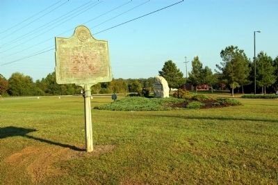
Here lived Dr. David Addison Reese, born in Mecklenberg County, N. C., son of a Revolutionary soldier and grandson of a signer of the Mecklenberg Declaration of Independence. When a young man Dr. Reese moved to Monticello and married Mary Gaines . . . — — Map (db m207808) HM
On Georgia Route 17, 1.5 miles north of Malloy Road (County Route 172), on the left when traveling south.
The area now called Old Town Plantation is shown on maps dating to the early 18th century. It was called Ogeechee Old Town because of the ancient Creek Indian town that Carolina traders visited before Georgia was founded in 1733. George Galphin of . . . — — Map (db m15734) HM
On Statesboro Road (U.S. 25) at Old Savannah Road, on the right when traveling south on Statesboro Road.
The highway crossing here is the Old Savannah Road, an early route from Savannah to Georgia’s western frontier. It follows the course of a former Indian trail to the Rock Landing on the Oconee, below today’s Milledgeville. There it intersected the . . . — — Map (db m38241) HM
On Georgia Route 18 at Five Points Road, on the right when traveling west on State Route 18.
The historic Gachet home is situated at the crossing of Towns and old Alabama Roads, called Milner Cross Roads. This road was also an Indian trail.
Benjamin Gachet, a French nobleman, fled from a San Domingo revolution and settled in what is . . . — — Map (db m24892) HM
On State Highway 199, 0.9 miles north of Interstate 16, on the right when traveling north. Reported missing.
Here lived George Michael Troup, Governor of Georgia 1823-27. Born in 1780 at McIntosh's Bluff on the Tombigbee River in a part of Georgia that is now
Alabama, he graduated at Princeton, 1797, and was admitted to the bar at Savannah, 1800. He . . . — — Map (db m11692) HM
On New York Road, 0.3 miles east of Old Leslie Road, on the right when traveling east.
Large Indian town home of the Chehaws. A friendly agricultural people of the Creek Tribe who aided our early settlers. They contributed men, food and horses to subdue the hostile Seminoles. Here Andrew Jackson rested with his starving army and was . . . — — Map (db m197060) HM
On U.S. 19, 0.1 miles north of Pinewood Road, on the right when traveling south.
Kennard's Settlement and Cowpens, a major Creek Indian center of Southwest Georgia, was located three and three-fourths miles west of here, on the east side of Kinchafoonee Creek. The site was named for Jack and William Kennard, two Lower Creek . . . — — Map (db m9844) HM
On Islands Highway (Georgia Route 38) at Kings Road, on the right when traveling east on Islands Highway.
Until about 1778 this island was called Bermuda, but afterward called Colonel’s Island because of the large number of colonels having plantations here. Major plantations included “Woodville,” “Herron’s Point,” . . . — — Map (db m62921) HM
On Georgia Route 57 at milepost 19 at Old Barrington Road, on the right when traveling east on State Route 57. Reported missing.
At this point, Highway 99 crosses the Old Barrington Road. A trail used by Indians centuries before the coming of the white men, this road was an important trade route between the Carolinas and Florida in the early 1700’s. With the settlement of . . . — — Map (db m58221) HM
On Auraria Road (Georgia Route 9) at Castleberry Bridge Road, on the left when traveling north on Auraria Road.
Auraria, (Gold), in 1832 the scene of Georgia’s first gold rush, was named by John C. Calhoun, owner of a nearby mine worked by Calhoun slaves. Auraria and Dahlonega were the two real gold towns in the U.S. before 1849. Between 1829 and 1839 about . . . — — Map (db m9950) HM
Branch One: Illustrates wildlife that roamed prehistoric Lumpkin County, including wild turkey, beavers, black bears, wolves, trout, panther, white-tailed deer, and golden eagle.
Branch Two: Illustrates the Native Americans of North Georgia. . . . — — Map (db m123716) HM
On Public Square North (Old U.S. 19) 0 miles west of North Park Street.
When surveyors laid out the original village, this square was designated The Public Square. The center of the Square was reserved for the construction of a courthouse, completed on 1836. The Public Square embodies the rights guaranteed to the people . . . — — Map (db m37369) HM
On Autaria Road (Georgia Route 9E) at Tanner Drive, on the right when traveling north on Autaria Road.
This is the site of one the forts or stations used by the United States Government in Cherokee country in 1838 to round up the Cherokee Indians for their removal to western reservations. General Winfield Scott, commander of the troops used to . . . — — Map (db m30369) HM
On U.S. 19 at Georgia Route 60, on the left when traveling north on U.S. 19.
This pile of stones marks the grave of a Cherokee princess, Trahlyta. According to legend her tribe, living on Cedar Mountain north of here, knew the secret of the magic springs of eternal youth from the Witch of Cedar Mountain.
Trahlyta, . . . — — Map (db m9451) HM
On Georgia Route 128 at Miona Spring Road (County Route 257), on the right when traveling north on State Route 128.
Upon the chartering of Macon County, by an Act approved December 29, 1837, the town of Lanier was made the first county seat. Until 1854 it was a bustling center for many of the earliest settlers in the county including Georgia Senator and Brig. . . . — — Map (db m40140) HM
On Chatham Street (Georgia Route 49) at N. Randolph Street, on the right when traveling south on Chatham Street.
Timothy Barnard, first white settler known to live on land now in Macon County, operated an Indian Trading Post on the west bank of the Flint River one mile southeast of here from pre-Revolutionary days until he died in 1820. For his loyalty to the . . . — — Map (db m27185) HM
On Georgia Route 41, 0 miles north of Fort Perry Road (County Route 49), on the right when traveling north.
One half mile due east lies the site of Fort Perry, along the Old Federal Road. A stockade fort, defended by block houses, this post was ordered erected by General John Floyd, of Camden county, as he led a body of 400 Georgia Militiamen through this . . . — — Map (db m27255) HM
On Broad Street (Georgia Route 41) at 5th Avenue, on the right when traveling north on Broad Street.
Built in 1850 of locally made brick, this is one of two courthouses standing in Marion County. The other built in 1848 is at Tazewell. The first courthouse was at Horry. When the county seat was moved here the town was called Pea Ridge. Wishing a . . . — — Map (db m27234) HM
On Georgia Route 41, 0 miles north of Fort Perry Road (County Route 49), on the left when traveling north.
The road crossing east and west here is the Old Federal Road, western Georgia’s first vehicular thoroughfare. Beginning at Fort Hawkins (now Macon) it led across the Creek Indian Country to the Alabama River above Mobile. Permission to open the . . . — — Map (db m27257) HM
On Augusta Highway (U.S. 278) at Ellington Airline Road, on the right when traveling east on Augusta Highway.
The Upper Trading Path, one of the historic Indian routes of the Southeast, passed this spot, leading from present Augusta to tribes as far west as the Mississippi River. By various connections the trail reached the Cherokees of North Georgia; the . . . — — Map (db m16002) HM
Near McIntosh Road at Wayne Street, on the right when traveling north.
Colonel Barnwell in early colonial records wrote about an Indian village that inhabited the site of Fort King George “for 40 acres round.” Thousands of sherds of Indian pottery, along with remains of 15 crude wautle and daub houses, have . . . — — Map (db m70239) HM
On Fairhope Road (Cooke Avenue), on the right when traveling south.
In this plot under the “Great Oak at Mallow Plantation,” Captain William McIntosh, father of the Indian chief, General William McIntosh, was buried in 1794. Captain McIntosh, an officer in the British army, when stationed in the Creek country, . . . — — Map (db m16172) HM
This plantation was a Crown grant to Captain John McIntosh, a British Army officer who served in Florida during the War with Spain. Later, when this officer went into the Indian country, his brother, the eccentric Captain Roderick (Rory) McIntosh, . . . — — Map (db m11448) HM
On Sutherland Bluff Dr., on the left when traveling south.
Sutherland`s Bluff, about 1.5 miles South on this road, overlooks the Sapelo River and the Inland Waterway. the site was named for Lieut. Patrick Sutherland, to whom it was granted, upon recommendation of General James Edward Oglethorpe, in . . . — — Map (db m12261) HM
On Coastal/Ocean Highway (U.S. 17), on the right when traveling south.
The service of this family to America, since the first of the Clan, with their leader, Captain John McIntosh Mohr, came from the Highlands of Scotland to Georgia, in 1736, forms a brilliant record.
The roll of distinguished members of this . . . — — Map (db m10503) HM
On Oakland Road (Georgia Route 85) at Magnolia Road (County Route 283), on the left when traveling south on Oakland Road.
The road from the east is a remnant of the Oakfuskee Path, main stem of the noted upper trading route from the Savannah River to the Creek Indians of Georgia and Alabama Beginning at present Augusta, it led this way via Warrenton, Eatonton, Griffin, . . . — — Map (db m42161) HM
On Greenville Street (Georgia Route 109) at Roosevelt Highway (U.S. 27), on the right when traveling east on Greenville Street.
The Oakfuskee Path, main branch of the famous Upper Creek trading route from the Savannah River to the Creek Indians, passed here. Beginning at present Augusta, it led through Greenville via Warrenton, Eatonton, Griffin and Flat Shoals of the Flint . . . — — Map (db m22205) HM
On South Jackson Street at West Main Street (U.S. 41), on the left when traveling south on South Jackson Street.
Created by Act of May 15, 1821, Monroe County, an original county containing all of Pike and parts of Bibb, Butts and Lamar Counties, was ceded by the Creek Indians in early 1821. Laid out by the Lottery Act, it was rapidly occupied by large numbers . . . — — Map (db m25941) HM
On Lower Apalachee Road, 0 miles east of Shockley Road, on the right when traveling east.
On the occasion of its Bicentennial, Morgan County places this Marker here to commemorate the community of Apalachee The name Apalachee is derived from the Indian Tribe that was part of the Creek Confederation, though there is no evidence that . . . — — Map (db m13418) HM
On West Main Street, 0.2 miles north of Parks Mill Road, on the left when traveling north.
On the occasion of its Bicentennial, Morgan County placed this marker here to commemorate the community of
Buckhead
One of the earliest settlements in Morgan County, the area around Buckhead was still in close proximity to Native . . . — — Map (db m16136) HM
On Williams Road, 0.1 miles west of Monticello Road (Georgia Route 83), on the left when traveling west.
On the occasion of its Bicentennial, Morgan County placed this marker here to commemorate the community of
Pennington
The Pennington Community was named for the Pennington family who first acquired land from ceded Native American . . . — — Map (db m16246) HM
On Eatonton Road (U.S. 441) at Seven Islands Road, on the right when traveling south on Eatonton Road.
The Seven Islands - Alabama Road - was an important emigrant route to the west. Travelers from northeast Georgia and the upper Carolinas followed this trace to the Mississippi Territory, Louisiana, and later Texas.
Originally an important link . . . — — Map (db m16223) HM
On Georgia Route 52 at Ellijay Street, on the left when traveling west on State Route 52.
—Surrounding you underneath are the graves of these nine people as well as those of several unknown individuals.
"I visited this burial place just at the close of a calm, clear summer evening, when the sun was sending back his last . . . — — Map (db m181849) HM
On Georgia Route 52 at Ellijay Street, on the left when traveling west on State Route 52.
"As she walked out in the fields, she taught her joyous flock the lessons of wisdom from the great book of nature spread open before them."
Born in Bethlehem, Pennsylvania in 1762, missionary Anna Rosina Kliest was described as . . . — — Map (db m181960) HM
On Georgia Route 225, on the right when traveling north.
Built of locally made brick in 1804, this house, the finest in the Cherokee Nation, was the home a Town Chief, James Vann, son of a Scotch trader, Clement Vann, and his wife, a Cherokee chieftain's daughter. Around his home were several of his . . . — — Map (db m18595) HM
On Carter, 2.5 miles north of Georgia Route 136, on the right.
In May 1539 Hernando de Soto landed in Florida with over 600 people, 220 horses and mules, and a herd of swine reserved for famine. Fired by his success in Pizarro's conquest of Peru, De Soto had been granted the rights, by the King of Spain, to . . . — — Map (db m27273) HM
On Old U.S. 411 at Old Federal Road South (U.S. 76), on the left when traveling north on U.S. 411. Reported missing.
The Old Federal Road, leading across the Indian Country from the Cherokee boundary, in the direction of Athens, branched at this point toward Knoxville and Nashville. The right turn led northward into Tennessee via Chatsworth and Tennga, while the . . . — — Map (db m180558) HM
One hundred yards east is the site of Fort Gilmer, built in 1838 to garrison U.S. troops ordered to enforce the removal from this region of the last Cherokee Indians under terms of the New Echota treaty of 1833.
One of seven such forts erected . . . — — Map (db m33860) HM
Near Old Fort Road, on the right when traveling south.
This ancient stone fortification,
885 feet in length, and the land on the crest
of this mountain, 2832 feet above sea level,
was given to the State of Georgia for the
establishment of Fort Mountain State Park
by
Ivan Allen
public spirited . . . — — Map (db m11572) HM
Near Old Fort Road, on the right when traveling south.
Legends of Fort Mountain:
The Moon-Eyed People
While some legends equate the moon-eyed people withe the descendants of Prince Madoc, Cherokee legends tell of the moon-eyed people that inhabited the Southern Highlands before they arrived. . . . — — Map (db m11590) HM
On Old Fort Road, on the right when traveling south.
The trail to the north of this site leads to the mysterious and prehistoric wall of loose rocks from which Fort Mountain takes its name. Many generations of explorers, archaeologists, geologists, historians and sight-seers have wondered about the . . . — — Map (db m46359) HM
On Old U.S. 411, 0.8 miles south of Coniston Road, on the right when traveling north.
The route veering southeastward is a remnant of the Old Federal Road, northwest Georgia’s earliest vehicular way and the first thoroughfare linking Tennessee and Georgia across the Cherokee Nation. Permission to open the highway was granted by the . . . — — Map (db m33869) HM
On Georgia Route 225 at Georgia Route 52, on the right when traveling north on State Route 225.
The earliest vehicular and postal route from northwest Georgia was the Federal Road, which led from the southeast Cherokee boundary, in the direction of Athens, Georgia to Tennessee; a Y-shaped thoroughfare, it forked at Ramhurst toward Knoxville . . . — — Map (db m18603) HM
Near Georgia Route 52 at Ellijay Street, on the left when traveling west.
Charles R. Hicks was one of the most influential Cherokee leaders of the early 19th century. Born in 1767 at Tomatly on the Hiawassee River, he was the son of a white trader named Nathan Hicks and a Cherokee woman of the wolf clan named Nancy Broom. . . . — — Map (db m182201) HM
Near Georgia Route 52 at Ellijay Street, on the right when traveling east.
"The day at Springplace began with all students up and dressed and kneeling in prayer. After breakfast, school was in session until lunch. The students spent the hours until late afternoon helping with various tasks around the . . . — — Map (db m181848) HM
On Hill Street (U.S. 411) 0.1 miles south of Mount Carmel Church Road, on the right when traveling north.
This highway follows closely the course of the Old Federal Road, the first vehicular and postal route to link Georgia and Tennessee across the Cherokee Nation. Informal permission to use the thoroughfare was granted by the Indians in 1803 and . . . — — Map (db m33867) HM
On Elm Street at Spring Place Smyrna Road, on the left when traveling north on Elm Street.
Near this spot, in 1838, Fort Hoskins was briefly established by the U.S. Army for use during the Cherokee Indian removal. Troops gathered over 100 Cherokees here who were then taken to Ross's Landing to begin their journey to what is now Oklahoma. . . . — — Map (db m180931) HM
On Georgia Route 225 at Georgia Route 52, on the right when traveling north on State Route 225.
Author of "Home, Sweet Home," suspected as a spy of the Cherokee Indians was imprisoned here in 1835, but released.
Erected by Old Guard of Atlanta Oct. 6, 1922;
Jos. A. McCord; Commandant — — Map (db m18592) HM
On Georgia Route 52 at Ellijay Street, on the right when traveling east on State Route 52.
Southward from this spot stood this famous mission, founded in 1801 by Moravian Brethren from Salem, N.C.
The first school among the Cherokees, this mission continued until 1833, and added much to their remarkable advancement.
Here were . . . — — Map (db m12328) HM
On U.S. 411, 0.3 miles north of Liberty Church Road, on the left when traveling north.
For the next 25 miles southward this highway coincides closely with the course of the Old Federal Road, the first vehicular and postal way to join Tennessee and Georgia across the Cherokee Nation. Beginning on the southeast Indian boundary in the . . . — — Map (db m33866) HM
On Victory Drive (U.S. 27) at Fort Benning Road, on the right when traveling north on Victory Drive.
On the summit of the rise to the east is the site of "Torch Hill", home of Dr. Francis Orray Ticknor (1822-1874), author of the famed war story, "Little Giffen of Tennessee". Dr. Ticknor was a physician at the Confederate Hospital on Upper Broad St. . . . — — Map (db m49073) HM
Near South Lumpkin Road, on the right when traveling south.
Cusseta lay on the rich flood plain of the Chattahoochee River, making it a fertile area for agriculture. Like Creeks throughout the Chattahoochee River valley the Cussetas grew a variety of vegetables, especially corn, squash, beans, and pumpkins. . . . — — Map (db m113718) HM
Near South Lumpkin Road, on the right when traveling south.
Cusseta was both an important political center for the Lower Creeks and a critical place for interaction with European colonial officials and later, American settlers. Occupying a strategic position in a vast trading network stretching from the Gulf . . . — — Map (db m113780) HM
Near South Lumpkin Road, on the right when traveling south.
The men and women of Cusseta had very defined roles in day to day life. Men were responsible not only for hunting and fishing, but for building homes and clearing ground for planting. Men made political decisions, including the decision to go to . . . — — Map (db m113759) HM
The Creek Indian War of 1835-1836,
which centered on Columbus, began when
a group of Indians revolted rather
than move from East Alabama to
Oklahoma they attacked travelers and
settlers and threatened Columbus.
State militia . . . — — Map (db m101487) HM
On 4th Street (U.S. 280) at 2nd Avenue, on the right when traveling east on 4th Street.
Having received word that the French and Spanish were exploiting the Indians´ grievances against the Carolina traders and encouraging the Indians to war against the British colonists in Ga., Oglethorpe informed the Trustees that he felt it was . . . — — Map (db m101255) HM
On Bay Avenue north of 11th Street, on the left when traveling north.
The Creek Indians and the Falls
To the native people of the Chattahoochee River Valley, the Muskogulgi or Creek Indians, these shoals were a place of recreation, a source of food, and the the home of the Tie Snake, Estakwanaya, a mythical . . . — — Map (db m112274) HM
Near South Lumpkin Road, on the right when traveling south.
The village of Cusseta (also known as Kasihta or Cussetuh) was one of the most important talwas (tvlwv), or political, economic, and cultural centers of the Lower Creek Indians. Believed to have been originally built on a large, flat . . . — — Map (db m113715) HM
On Bay Avenue north of 11 Street, on the right when traveling north.
The Fall Line You are standing at the fall line that separates the higher and hilly Piedmont region from the relatively level Coastal Plain. Rivers flowing from the mountains toward the sea always experience a series of rapids or falls as they . . . — — Map (db m112287) HM
On West Church Street, 0 miles west of Anderson Avenue, on the left when traveling east.
Here on the Indian Path that connected two Indian Trails, from Hartford to Fort Hawkins and from Barnard’s Crossing to the Old Creek Agency, James Abbington Everett established, in the 1820’s, the Indian Trading Post around which Fort Valley arose. . . . — — Map (db m53096) HM
On East Church Street (Georgia Route 53) 0.1 miles south of Old Tate Highway, on the right when traveling north.
This highway from Tate to Talking Rock follows substantially the course of the Old Federal Road, the earliest thoroughfare to link Georgia and Tennessee across the Cherokee Nation. Permission to use the way was granted informally by the Indians in . . . — — Map (db m22650) HM
On Georgia Route 136, 1 mile north of Connector Georgia Route 136 Connector Road, on the left when traveling north. Reported missing.
The road running west of here down Talking Rock Creek to the site of Coosawatee Old Town is a portion of the Old Federal Road opened through the Cherokee Nation, in 1805, by Georgia and Tennessee. It follows the course of a trail shown on a map of . . . — — Map (db m51211) HM
On Ellijay Road (Old Georgia Route 5) at Georgia Route 136, in the median on Ellijay Road. Reported missing.
The highway leading right is the Old Federal Road, northwest Georgia’s earliest vehicular route. It began on the Cherokee boundary, in the direction of Athens, Georgia and led this was to Tennessee. Permission to open the trace was granted . . . — — Map (db m60524) HM
On Georgia Route 136 at Ellijay Road (Georgia Route 382), on the right when traveling east on State Route 136.
Just west of here in 1819 the American Board of Commissioners for Foreign Missions established a mission station to the Cherokee Indians. Moody Hall and Henry Parker were the first missionaries sent to Carmel (originally known as Taloney), March 12, . . . — — Map (db m21717) HM
On Georgia Route 53 at Red Bird Way, on the right when traveling east on State Route 53. Reported missing.
The highway coming from the right is the Old Federal Road, northwest Georgia’s first vehicular way and the earliest postal route of this area. It began on the southeastern boundary of the Cherokees in the direction of Athens, linking Georgia and . . . — — Map (db m60508) HM
On Wissahickon Avenue at Essex Avenue, on the right when traveling east on Wissahickon Avenue.
Asa Prior, born in Virginia about 1785, pioneered into this valley and purchased a large tract of land including this spring and Cedar Creek in 1834. In 1852 he deeded the spring and 10 adjacent acres to the City of Cedartown. Another pioneer, Mr. . . . — — Map (db m35812) HM
On South Main Street (Business U.S. 27) at Grace Street, on the right when traveling south on South Main Street.
The earliest known inhabitants in the Cedartown area were the Cherokee Indians, who had taken over the surrounding territory from the Creek Indians in the 1760's. Cherokee settlements in the area were known as Char'le Town, Cedar Town and Clean . . . — — Map (db m197547) HM
On Wissahickon Avenuye at North Cave Spring Street, on the right when traveling east on Wissahickon Avenuye.
The area surrounding the Cedartown Big Springs was first inhabited by the Cherokee Indians. The land was prized for its abundance of sparkling spring water and shade-providing cedar trees. The Cherokee people lived here peacefully until May 26, 1838 . . . — — Map (db m107439) HM
On Golden Isles Parkway (U.S. 341) at Airport Road, on the right when traveling east on Golden Isles Parkway.
In commemoration of the
De Soto Expedition
1540
Old Hartford on the Ocmulgee is near the ancient site of Ocute on the eastward flowing river where dwelt the Hitchiti Indians. De Soto and his army reached Ocute, capital town of Ocute . . . — — Map (db m111448) HM
On Broad Street (U.S. 129/341) 0.1 miles west of Georgia Route 26, on the right when traveling west.
This is old Hartford, from 1809 until 1836 the seat of Pulaski County, and during those years a thriving city, influential in the military and political life of Georgia. Long before that time, the site was an important trading center for the Indians . . . — — Map (db m40327) HM
On Commerce Street (Georgia Route 26) at North Lumpkin Street, on the right when traveling east on Commerce Street.
Slosheye Trail was used by the Indians and white traders as an artery of travel as early as 1750 and extended from Hawkinsville on the Ocmulgee River to Drayton on the Flint River. This ancient trail passed through Hawkinsville over the present . . . — — Map (db m40328) HM
On Madison Highway (U.S. 129) at Rock Eagle Road, on the left when traveling north on Madison Highway.
One mile west of this point is a stone mound believed to have been constructed by prehistoric Indians before Columbus discovered America. The mound is composed of white quartz rocks, forming the shape of a bird in flight with its head turned toward . . . — — Map (db m34124) HM
On Main Street, 0 miles south of Harrison Street, on the right when traveling south.
Settled in the early 1830’s this town was first named Tobanana for the nearby creek. The Tobanana post office was established January 10, 1833, and the name was changed to Georgetown September 21, 1836, in honor of Georgetown, District of . . . — — Map (db m46588) HM
On Pine Street at Court Street, on the right when traveling west on Pine Street.
Early Randolph County
The area that is now Randolph County lies within the vast territory in Georgia and Alabama once claimed by the Creeks. In the late 1700s and early 1800s several small Creek towns were scattered throughout the area, . . . — — Map (db m113738) HM
On Pine Street at Court Street, on the right when traveling west on Pine Street.
Located within what had long been Creek territory and containing portions of well-used trails connecting the area with the Seminoles in Florida, Randolph County became an important scene of action during the Second Creek War (1836-38). The war came . . . — — Map (db m223533) HM
To commemorate the great congress of
five Indian Nations held here at Fort
Augusta in 1763. When seven hundred
Indians came to meet the Governors of
Georgia, Virginia, North and South Carolina. — — Map (db m9899) HM
On McDowell Street at Johns Road, on the right when traveling west on McDowell Street.
The colonial Great Indian Trading Path crossed land now a part of Augusta College and followed a part of the present McDowell Street. It was variously called Trading Road, Augusta Road, and the Creek Indian Path. Early platts show it on land owned . . . — — Map (db m10008) HM
The most heavily traveled road in Colonial America passed through here, linking areas from the Great Lakes to Augusta, GA. Laid on ancient animal and Native American Trading/Warrior Paths. Indian treaties among the governors of NY, PA, & VA and the . . . — — Map (db m9906) HM
Near 8th Street north of Reynolds Street, on the left when traveling north.
Archaeological evidence has proven the existence of Indian villages in the Augusta area as early as 2,500 B.C., and a type of decorated pottery found at various sites is among the oldest in North America.
Just north of the present-day city . . . — — Map (db m114286) HM
On Cumming Road at Johns Road, on the right when traveling east on Cumming Road.
In this cemetery are buried the following eminent Georgians:
JOHN MILLEDGE (1757-1818), Revolutionary officer, Congressman, Governor (1802-1806). He gave the land on which the University of Georgia is built.
GEORGE WALKER CRAWFORD . . . — — Map (db m14871) HM
William Bartram Visits Augusta
1773 for Indian Ceded Lands Treaty.
1775 said . . . ."Augusta would become
the Metropolis of Georgia" — — Map (db m9762) HM
On State Park Drive, 0.1 miles south of Georgia Route 253, on the right when traveling east.
Located in Seminole County, near the forks of the Chattahoochee and Flint Rivers, was a town of Hitchiti-speaking, Lower Creek Indians. A Spanish mission, Santa Cruz de Sabacola el Menor, was established there in 1675. By 1685, English traders from . . . — — Map (db m17834) HM
On Estanollee School Road, 0.5 miles west of Georgia Route 17, on the right when traveling west.
Organized officially in 1917 as Eastanollee High School, taking its name from the old Eastanollee School -– a name of Indian origin meaning “a ledge of rocks across a stream.” In 1926 it became the county high school, and in 1929 . . . — — Map (db m16867) HM
On East Main Street (Georgia Route 17) at Red Hollow Road, on the left when traveling north on East Main Street.
Winding along a ridge from the mouth of Broad River to the head at Tugalo, RED HOLLOW ROAD evolved from the noted trace, UPPER CHEROKEE PATH, and became part of a complex pioneer road system.
In 1736-1737, Oglethorpe had River Road laid out . . . — — Map (db m14564) HM
On Riverdale Road just north of Manor Oak, on the right when traveling north.
According to Jarrett family tradition, Devereaux Jarrett's slaves discovered
this "Indian Rock” along the Tugaloo River in the 1830s. Recognizing the
significance of this unique stone and its petroglyphs, Jarrett had it placed
under his . . . — — Map (db m161555) HM
On East Currahee Street (U.S. 123) 0.1 miles east of Old Roberts Road, on the left when traveling east.
North of this marker, in the center of the lake, once stood an important Indian town. The area now marked by a small island was settled around 500 A.D. and occupied by Cherokee Indians around 1450. Traders were coming to the town by 1690.
In . . . — — Map (db m10014) HM
Near Florence Road, 0.1 miles west of Georgia Route 39, on the right when traveling north.
Located on this site was the frontier town of Florence, which was incorporated on December 14, 1837 after the Creek Indians burned the nearby town of Roanoke in 1836. Florence was originally named Liverpool after the English port city. For many . . . — — Map (db m182134) HM WM
On Forsyth Street (entrance to Westville Village), 0.4 miles east of Westville Village Museum Store.
Westville Symposium
On October 12, 1973 an informal group of fifty persons, having an interest in several areas of academic research, met at Westville's Yellow Creek campmeeting tabernacle for a three day symposium to discuss a subject of . . . — — Map (db m21857) HM
On Omaha Road (Route 39) 1 mile north of Canyon Road (Route 39C), on the left when traveling south.
On this site was fought the battle of Shepherd's Plantation between Creek Indians and pioneer settlers aided by volunteer soldiers stationed at Forts Ingersol, Jones and McCreary under Major Henry W. Jernigan and Captain Hamilton Garmany.
On a . . . — — Map (db m46361) HM
On Georgia Route 39 at milepost 15,, 0.9 miles east of Holtzclaw Road, on the left when traveling east.
Three miles west on the Chattahoochee River was Oconee Village, home of the Oconee Indians from 1715 to 1799. Their Chief Oueekachumfa or Long King signed the treaty with General Oglethorpe at Cowetah, August 21, 1739. In the 1750s, led by Chief . . . — — Map (db m117032) HM
On Georgia Route 39, 3 miles south of Georgia Route 39C, on the right when traveling south. Reported missing.
Roanoke, ½ mile west of here on the east bank of the Chattahoochee River was originally an Indian village. Incorporated in 1832 with about 30 families, a post office and several stores, it became a thriving white settlement. Roanoke was . . . — — Map (db m46280) HM
On Georgia Route 208, 0.4 miles east of Buckner Road, on the right when traveling west.
The Federal Road across the Creek Indian County, western Georgia’s first vehicular way, passed here leading from Fort Hawkins (now Macon) to the Alabama River above Mobile. The trace, which followed closely the course of the earlier noted Lower . . . — — Map (db m27366) HM
On Broad Street (U.S. 278) at Monument street, on the right when traveling west on Broad Street.
The colonial road from Charleston to Vicksburg followed the highway at this point. The route, used by Col. Langdon Welch on his expedition to the Mississippi in 1698, was thereafter followed by British traders. Through Taliaferro Co., it followed . . . — — Map (db m15242) HM